Area Overview for CR2 1XH
Photos of CR2 1XH
Area Information
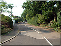
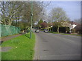
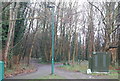
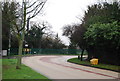
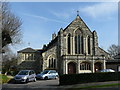
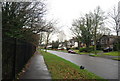
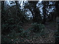
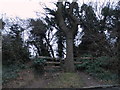
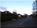
Living in CR2 1XH places you in the heart of Purley, a suburban area within the London Borough of Croydon. With a population of 1,933, this small postcode area reflects the character of a tightly knit residential cluster, centred on Purley High Street and Woodcote Village Green. The area’s name traces back to the 13th century, derived from an Anglo-Saxon estate meaning “pear tree clearing,” a legacy that persists in its historic charm. Modern Purley balances early 20th-century development with contemporary living, including the gated Webb Estate, known for its Edwardian homes and private amenities. Daily life here is defined by proximity to local shops, schools, and transport links, while the surrounding landscape includes the Bourne river, though its culverted course occasionally raises flood concerns in nearby valleys. The area’s mix of residential tranquillity and suburban convenience makes it appealing to families and professionals seeking a stable, community-focused environment.
- Area Type
- Postcode
- Area Size
- Not available
- Population
- Not available
- Population Density
- Not available
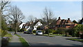
CR2 1XH is predominantly a home-owning area, with 75% of properties occupied by owners rather than renters. This suggests a stable market with long-term residents and limited rental activity. The accommodation type is primarily houses, which aligns with the suburban character of the area and the presence of developments like the Webb Estate. These properties are likely family homes, offering more space than apartments, which suits the age profile of the community. Buyers should expect a market where properties are held for longer periods, with potential for capital growth in a low-turnover environment. The small area’s proximity to transport and amenities may make it attractive to those seeking a balance between urban accessibility and residential comfort. However, the limited size of the postcode means buyers should consider nearby areas for a broader range of options.
House Prices in CR2 1XH
No properties found in this postcode.
Energy Efficiency in CR2 1XH
Residents of CR2 1XH enjoy a mix of suburban tranquillity and practical amenities. The area’s retail options include major supermarkets like Sainsburys Purley and Tesco Purley, alongside Co-op Wallington, ensuring easy access to groceries and daily essentials. Public transport is well-integrated, with rail and tram services connecting to nearby hubs. The Webb Estate offers a unique blend of private gardens, historic architecture, and community spaces, while Woodcote Village Green provides a focal point for local activities. The Bourne river, though culverted, is part of the area’s natural heritage, though flood risks are low. Parks and open spaces, such as the planned Iron Horse art installation, add cultural and recreational value. This combination of retail, transport, and green spaces supports a balanced lifestyle, ideal for families and professionals.
Amenities
Schools
Residents of CR2 1XH have access to two primary schools with good Ofsted ratings: Margaret Roper Catholic Primary School and Thomas More Catholic School. Both institutions provide quality education for younger children, offering a structured curriculum and community-focused environments. The presence of two primary schools within the area reduces the need for long commutes, which is particularly beneficial for families. While no secondary schools are listed, the proximity to Purley High Street and nearby wards may provide additional options. The Catholic affiliation of both schools may appeal to families seeking faith-based education, though non-religious alternatives may require travel. The good Ofsted ratings indicate that these schools meet national standards for teaching quality and student outcomes.
| Rank | School | Type | Entry gender | Ages |
|---|
Explore more schools in this area
Go to Schools tabDemographics
CR2 1XH has a median age of 47, with the majority of residents falling within the 30–64 age range. This suggests a mature, established community, likely with long-term residents and families. Home ownership is high at 75%, indicating a strong presence of owner-occupied properties, which often correlates with stability and investment in local infrastructure. The predominant accommodation type is houses, reflecting a suburban layout rather than high-density housing. The predominant ethnic group is White, though no specific data on diversity or deprivation is provided. This demographic profile implies a community focused on family living, with a low turnover of residents. The age range and ownership rates suggest a balance between professional careers and retirement, with limited evidence of transient populations or student communities.
Household Size
Accommodation Type
Tenure
Ethnic Group
Religion
Household Composition
Age
Household Deprivation
NS-SEC
Explore more demographic insights in this area
Go to Demographics tabPlanning
Planning Constraints
- Flood RiskPremium
- Ramsar Wetland SitesPremium
- Area of Outstanding Natural BeautyPremium
- Protected Nature ReservePremium
- Protected WoodlandPremium