Area Overview for CR2 0QP
Photos of CR2 0QP
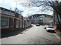
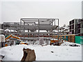
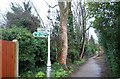
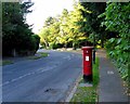
88 photos from this area
Area Information
Key information about the CR2 0QP including its size, population, and administrative classification.
- Area Type
- Postcode
- Area Size
- 1.4 hectares
- Population
- Not available
- Population Density
- Not available
House Prices in CR2 0QP
24
Properties
£402,537
Average Sold Price
£120,000
Lowest Price
£660,000
Highest Price
Showing 24 properties
| Address | Type | Beds | Baths | Last Sale Price | Last Sale Date | |
|---|---|---|---|---|---|---|
| 9 Victoria Avenue, South Croydon, CR2 0QP | Detached | 4 | 1 | £600,000 | Dec 2025 | |
| 18 Victoria Avenue, South Croydon, CR2 0QP | house | - | - | £371,566 | Aug 2025 | |
| 13 Victoria Avenue, South Croydon, CR2 0QP | house | - | - | £550,000 | Jan 2023 | |
| 16 Victoria Avenue, South Croydon, CR2 0QP | house | - | - | £660,000 | Sep 2022 | |
| 6 Victoria Avenue, South Croydon, CR2 0QP | Semi-detached | 3 | 1 | £573,000 | Aug 2020 | |
| 26 Victoria Avenue, South Croydon, CR2 0QP | house | - | - | £367,000 | Sep 2010 | |
| 8 Victoria Avenue, South Croydon, CR2 0QP | house | - | - | £395,000 | Jul 2010 | |
| 14 Victoria Avenue, South Croydon, CR2 0QP | Detached | 4 | 2 | £560,000 | May 2009 | |
| 11 Victoria Avenue, South Croydon, CR2 0QP | Semi-detached | - | - | £395,000 | Jun 2008 | |
| 22 Victoria Avenue, South Croydon, CR2 0QP | Detached | 4 | 1 | £390,000 | Mar 2007 |
Page 1 of 3
Energy Efficiency in CR2 0QP
Amenities
Schools
| Rank | School | Type | Entry gender | Ages |
|---|
Explore more schools in this area
Go to Schools tabDemographics
Household Size
Family (3-5 people)
most common
Accommodation Type
Houses
most common
Tenure
71
majority
Ethnic Group
White
most common
Religion
N/A
most common
Household Composition
N/A
most common
Age
47
median
Adults (30-64 years)
most common
Household Deprivation
N/A
with no deprivation
NS-SEC
49
in Lower managerial occupations
Explore more demographic insights in this area
Go to Demographics tabPlanning
Planning Constraints
- Flood RiskPremium
- Ramsar Wetland SitesPremium
- Area of Outstanding Natural BeautyPremium
- Protected Nature ReservePremium
- Protected WoodlandPremium