Area Overview for CR2 0PF
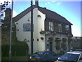
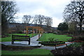
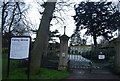
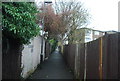
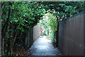
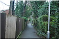
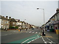
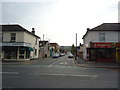
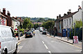
Photos of CR2 0PF
Area Information
Postcode CR2 0PF defines a small residential cluster covering just 2,283 square metres in the London Borough of Croydon. This compact area sits on the historic southern edge of London, emerging in the 19th century from the ancient manors of Croham and Haling. You can expect to live among a population of 1,730 residents who call this specific postcode home. The location benefits from land that was once part of Croham Hurst, a woodland area purchased as public open space in 1901 after significant local campaigning. This historical depth shapes the character of living in CR2 0PF, blending older suburban roots with modern convenience. The area developed from land held by Archbishop Lanfranc back in the Domesday Book, situated near the historic London-Brighton coaching route known today as Brighton Road. Residents enjoy proximity to districts like South Croydon and Purley Oaks, linking daily life to a broader network of established communities within Greater London. While the total population figure for the ward is approximately 1,440, your specific cluster hosts 1,730 people across a very concentrated footprint. Living here means access to a rich history, including the Whitgift Foundation legacy and the local film director David Lean, while maintaining a distinct residential identity separate from the town centre.
- Area Type
- Postcode
- Area Size
- 2283 m²
- Population
- 1730
- Population Density
- 8653 people/km²
Living in CR2 0PF involves entering a property market defined by high-density flats within a very limited land area of 2,283 square metres. With 46% of households choosing home ownership, the market contains a significant number of owner-occupied units alongside a substantial rental sector. The predominant accommodation type is flats, meaning you are unlikely to find traditional semi-detached or terraced houses within this specific postcode boundary. This high proportion of flats aligns with the population density of 757,931 people per square kilometre, creating a compact, vertical living environment. Buyers looking at this area should understand that the housing stock is suited to urban living rather than garden-focused suburbs. The small footprint means development pressure could be high, yet the current static nature suggests a mature market where existing stock is the primary option. Prospective buyers must adapt to a lifestyle characterised by communal living arrangements typical of flat developments. The mix of ownership and tenure offers flexibility, but the structural reality of the housing remains consistent: almost all dwellings are flats. This distinction is crucial for anyone considering homes in CR2 0PF, as it dictates the nature of neighbours and the building design.
House Prices in CR2 0PF
Showing 16 properties
| Address | Type | Beds | Baths | Last Sale Price | Last Sale Date | |
|---|---|---|---|---|---|---|
| 61 Sanderstead Road, South Croydon, CR2 0PF | Terraced | 3 | 2 | £300,000 | Mar 2025 | |
| 73 Sanderstead Road, South Croydon, CR2 0PF | Terraced | 2 | 1 | £372,000 | Oct 2022 | |
| 87 Sanderstead Road, South Croydon, CR2 0PF | house | - | - | £460,000 | Mar 2021 | |
| 81 Sanderstead Road, South Croydon, CR2 0PF | Terraced | 2 | 1 | £311,000 | Jun 2018 | |
| 85 Sanderstead Road, South Croydon, CR2 0PF | Semi-detached | 3 | 2 | £425,000 | Aug 2017 | |
| 71 Sanderstead Road, South Croydon, CR2 0PF | Terraced | 2 | 1 | £283,000 | Apr 2017 | |
| 65 Sanderstead Road, South Croydon, CR2 0PF | house | - | - | £220,050 | Jan 2008 | |
| 79 Sanderstead Road, South Croydon, CR2 0PF | house | - | - | £160,000 | Dec 2006 | |
| 67 Sanderstead Road, South Croydon, CR2 0PF | house | - | - | £175,000 | Apr 2006 | |
| 63 Sanderstead Road, South Croydon, CR2 0PF | house | 2 | 1 | £158,000 | Mar 2003 |
Energy Efficiency in CR2 0PF
Daily life in CR2 0PF is supported by a wide range of amenities located within practical reach, offering genuine convenience for residents. You have access to five railway stations including Sanderstead, Purley Oaks, and South Croydon Station, giving you multiple options for commuting into Central London or the south coast. Retail needs are easily met with five major supermarkets nearby, such as Tesco Sanderstead, Sainsburys Croydon, and Tesco Croydon, ensuring you can shop for groceries without extensive travel. Public transport is further enhanced by five tram stops, including Lloyd Park, George Street, and Church Street, providing local connectivity around the district. For airport access, two options exist within reach: London Biggin Hill Airport and Biggin Hill Airport, which serves general aviation and regional travel. These transport links integrate seamlessly into your weekly routine. Living here means you do not need to travel far for essential services or leisure activities. The presence of these five rail links and five retail outlets creates a self-sufficient environment where most daily errands require minimal effort.
Amenities
Schools
| Rank | School | Type | Entry gender | Ages |
|---|
Explore more schools in this area
Go to Schools tabDemographics
The community profile for CR2 0PF reflects a mature and established local population with a median age of 47 years old. Most residents fall into the adult age range between 30 and 64 years, indicating a neighbourhood favoured by families and professionals in mid-career. Home ownership stands at 46%, a figure that suggests a balanced mix of owners, shared owners, and tenants within this specific cluster. The predominant accommodation type here consists of flats rather than detached or semi-detached houses, which shapes the density and layout of the streets you will navigate. The demographic composition is primarily White, consistent with the broader patterns seen across the London Borough of Croydon. These factors combine to create a stable environment where many households have been settled for years. The high concentration of adults in productive work years supports local businesses and services. You will find a community where families and older residents coexist in a primarily flat-based housing stock. This profile distinguishes CR2 0PF from areas dominated by student housing or young professionals moving for single occupancies.
Household Size
Accommodation Type
Tenure
Ethnic Group
Religion
Household Composition
Age
Household Deprivation
NS-SEC
Explore more demographic insights in this area
Go to Demographics tabPlanning
Planning Constraints
- Flood RiskPremium
- Ramsar Wetland SitesPremium
- Area of Outstanding Natural BeautyPremium
- Protected Nature ReservePremium
- Protected WoodlandPremium