Area Overview for CR0 9EW
Photos of CR0 9EW
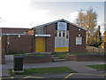
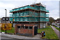
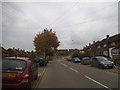
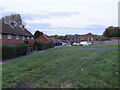
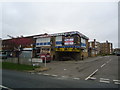
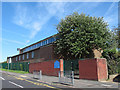

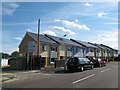
24 photos from this area
Area Information
Key information about the CR0 9EW including its size, population, and administrative classification.
- Area Type
- Postcode
- Area Size
- 1.7 hectares
- Population
- 1604
- Population Density
- 6273 people/km²
House Prices in CR0 9EW
43
Properties
£131,725
Average Sold Price
£43,750
Lowest Price
£325,000
Highest Price
Showing 43 properties
| Address | Type | Beds | Baths | Last Sale Price | Last Sale Date | |
|---|---|---|---|---|---|---|
| 52 Danebury, Field Way, Croydon, CR0 9EW | Terraced | 3 | 1 | £325,000 | Jul 2023 | |
| 53 Danebury, Field Way, Croydon, CR0 9EW | Terraced | - | - | £108,000 | Jul 2010 | |
| 46 Danebury, Field Way, Croydon, CR0 9EW | house | - | - | £182,500 | Sep 2007 | |
| 44 Danebury, Field Way, Croydon, CR0 9EW | Terraced | - | - | £174,000 | Aug 2007 | |
| 60 Danebury, Field Way, Croydon, CR0 9EW | Terraced | - | - | £165,000 | Nov 2006 | |
| 57 Danebury, Field Way, Croydon, CR0 9EW | Terraced | - | - | £136,000 | Apr 2004 | |
| 48 Danebury, Field Way, Croydon, CR0 9EW | Terraced | - | - | £74,000 | Mar 2000 | |
| 38 Danebury, Field Way, Croydon, CR0 9EW | house | - | - | £64,000 | Feb 1998 | |
| 40 Danebury, Field Way, Croydon, CR0 9EW | house | - | - | £45,000 | Apr 1996 | |
| 41 Danebury, Field Way, Croydon, CR0 9EW | house | - | - | £43,750 | Apr 1996 |
Page 1 of 5
Energy Efficiency in CR0 9EW
Amenities
Schools
| Rank | School | Type | Entry gender | Ages |
|---|
Explore more schools in this area
Go to Schools tabDemographics
Household Size
Family (3-5 people)
most common
Accommodation Type
Houses
most common
Tenure
24
majority
Ethnic Group
White
most common
Religion
N/A
most common
Household Composition
N/A
most common
Age
47
median
Adults (30-64 years)
most common
Household Deprivation
N/A
with no deprivation
NS-SEC
18
in Lower managerial occupations
Explore more demographic insights in this area
Go to Demographics tabPlanning
Planning Constraints
- Flood RiskPremium
- Ramsar Wetland SitesPremium
- Area of Outstanding Natural BeautyPremium
- Protected Nature ReservePremium
- Protected WoodlandPremium