Area Overview for CR0 8JT
Photos of CR0 8JT

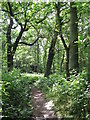
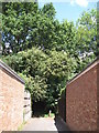
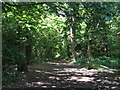
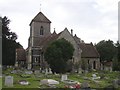
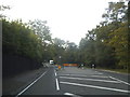
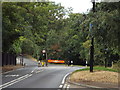
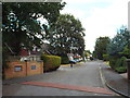
65 photos from this area
Area Information
Key information about the CR0 8JT including its size, population, and administrative classification.
- Area Type
- Postcode
- Area Size
- 6332 m²
- Population
- 1764
- Population Density
- 12773 people/km²
House Prices in CR0 8JT
24
Properties
£166,089
Average Sold Price
£38,750
Lowest Price
£330,000
Highest Price
Showing 24 properties
| Address | Type | Beds | Baths | Last Sale Price | Last Sale Date | |
|---|---|---|---|---|---|---|
| 51 Fir Tree Gardens, Croydon, CR0 8JT | Flat | - | - | £245,000 | Oct 2023 | |
| 53 Fir Tree Gardens, Croydon, CR0 8JT | Flat | - | - | £330,000 | May 2018 | |
| 49 Fir Tree Gardens, Croydon, CR0 8JT | Flat | - | - | £200,000 | Mar 2017 | |
| 65 Fir Tree Gardens, Croydon, CR0 8JT | Flat | - | - | £185,000 | Dec 2014 | |
| 63 Fir Tree Gardens, Croydon, CR0 8JT | Flat | - | - | £110,000 | Sep 2004 | |
| 87 Fir Tree Gardens, Croydon, CR0 8JT | Flat | - | - | £120,010 | Dec 2003 | |
| 59 Fir Tree Gardens, Croydon, CR0 8JT | Flat | - | - | £99,950 | Oct 2002 | |
| 57 Fir Tree Gardens, Croydon, CR0 8JT | Flat | - | - | £38,750 | Jul 1998 | |
| 89 Fir Tree Gardens, Croydon, CR0 8JT | Flat | - | - | - | - | |
| 91 Fir Tree Gardens, Croydon, CR0 8JT | Flat | - | - | - | - |
Page 1 of 3
Energy Efficiency in CR0 8JT
Amenities
Schools
| Rank | School | Type | Entry gender | Ages |
|---|
Explore more schools in this area
Go to Schools tabDemographics
Household Size
Family (3-5 people)
most common
Accommodation Type
Flats
most common
Tenure
20
majority
Ethnic Group
black_total
most common
Religion
N/A
most common
Household Composition
N/A
most common
Age
22
median
Adults (30-64 years)
most common
Household Deprivation
N/A
with no deprivation
NS-SEC
20
in Lower managerial occupations
Explore more demographic insights in this area
Go to Demographics tabPlanning
Planning Constraints
- Flood RiskPremium
- Ramsar Wetland SitesPremium
- Area of Outstanding Natural BeautyPremium
- Protected Nature ReservePremium
- Protected WoodlandPremium