Area Overview for CR0 8HR
Photos of CR0 8HR
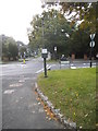
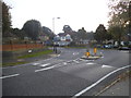
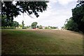
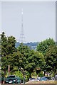
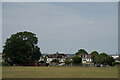
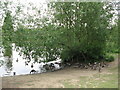
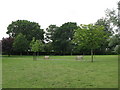
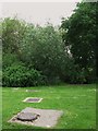
58 photos from this area
Area Information
Key information about the CR0 8HR including its size, population, and administrative classification.
- Area Type
- Postcode
- Area Size
- 1.3 hectares
- Population
- 1679
- Population Density
- 3725 people/km²
House Prices in CR0 8HR
18
Properties
£464,893
Average Sold Price
£115,000
Lowest Price
£645,000
Highest Price
Showing 18 properties
| Address | Type | Beds | Baths | Last Sale Price | Last Sale Date | |
|---|---|---|---|---|---|---|
| 34 Farm Drive, Croydon, CR0 8HR | Bungalow | 2 | 1 | £530,000 | Jan 2025 | |
| 16 Farm Drive, Croydon, CR0 8HR | Bungalow | 2 | 1 | £635,000 | Oct 2024 | |
| 2 Farm Drive, Croydon, CR0 8HR | Bungalow | 2 | 1 | £590,000 | Feb 2024 | |
| 32 Farm Drive, Croydon, CR0 8HR | Bungalow | - | - | £645,000 | Apr 2022 | |
| 26 Farm Drive, Croydon, CR0 8HR | Bungalow | - | - | £550,000 | Oct 2020 | |
| 10 Farm Drive, Croydon, CR0 8HR | Bungalow | 2 | - | £530,000 | Apr 2019 | |
| 24 Farm Drive, Croydon, CR0 8HR | Bungalow | 3 | - | £550,000 | Jan 2019 | |
| 18 Farm Drive, Croydon, CR0 8HR | Bungalow | 2 | - | £497,000 | Nov 2015 | |
| 6 Farm Drive, Croydon, CR0 8HR | Bungalow | 2 | 1 | £423,500 | Aug 2015 | |
| 20 Farm Drive, Croydon, CR0 8HR | Bungalow | - | - | £360,000 | Sep 2010 |
Page 1 of 2
Energy Efficiency in CR0 8HR
Amenities
Schools
| Rank | School | Type | Entry gender | Ages |
|---|
Explore more schools in this area
Go to Schools tabDemographics
Household Size
Family (3-5 people)
most common
Accommodation Type
Houses
most common
Tenure
85
majority
Ethnic Group
White
most common
Religion
N/A
most common
Household Composition
N/A
most common
Age
47
median
Adults (30-64 years)
most common
Household Deprivation
N/A
with no deprivation
NS-SEC
40
in Lower managerial occupations
Explore more demographic insights in this area
Go to Demographics tabPlanning
Planning Constraints
- Flood RiskPremium
- Ramsar Wetland SitesPremium
- Area of Outstanding Natural BeautyPremium
- Protected Nature ReservePremium
- Protected WoodlandPremium