Area Overview for CR0 7SQ
Photos of CR0 7SQ
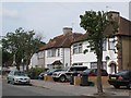
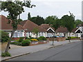
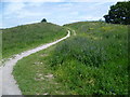
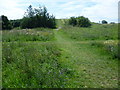
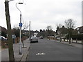
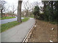
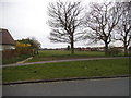
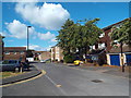
92 photos from this area
Area Information
Key information about the CR0 7SQ including its size, population, and administrative classification.
- Area Type
- Postcode
- Area Size
- 1.8 hectares
- Population
- 1737
- Population Density
- 3893 people/km²
House Prices in CR0 7SQ
22
Properties
£317,731
Average Sold Price
£92,000
Lowest Price
£580,000
Highest Price
Showing 22 properties
| Address | Type | Beds | Baths | Last Sale Price | Last Sale Date | |
|---|---|---|---|---|---|---|
| 6 The Rosery, Croydon, CR0 7SQ | Bungalow | 3 | 2 | £385,000 | Mar 2025 | |
| 5 The Rosery, Croydon, CR0 7SQ | house | - | - | £580,000 | Jul 2022 | |
| 12 The Rosery, Croydon, CR0 7SQ | Semi-detached | 3 | 1 | £458,000 | Jan 2018 | |
| 26 The Rosery, Croydon, CR0 7SQ | Bungalow | - | - | £420,000 | May 2016 | |
| 16 The Rosery, Croydon, CR0 7SQ | Semi-detached | 3 | - | £440,000 | Nov 2015 | |
| 3 The Rosery, Croydon, CR0 7SQ | Semi-detached | 6 | 3 | £445,000 | Jul 2014 | |
| 14 The Rosery, Croydon, CR0 7SQ | Flat | - | - | £140,000 | Jun 2010 | |
| 4 The Rosery, Croydon, CR0 7SQ | Semi-detached | 3 | 1 | £276,000 | May 2006 | |
| 7 The Rosery, Croydon, CR0 7SQ | Terraced | - | - | £267,500 | Oct 2005 | |
| 24 The Rosery, Croydon, CR0 7SQ | Detached | 3 | 2 | £225,000 | Jul 2004 |
Page 1 of 3
Energy Efficiency in CR0 7SQ
Amenities
Schools
| Rank | School | Type | Entry gender | Ages |
|---|
Explore more schools in this area
Go to Schools tabDemographics
Household Size
Family (3-5 people)
most common
Accommodation Type
Houses
most common
Tenure
90
majority
Ethnic Group
White
most common
Religion
N/A
most common
Household Composition
N/A
most common
Age
47
median
Adults (30-64 years)
most common
Household Deprivation
N/A
with no deprivation
NS-SEC
39
in Lower managerial occupations
Explore more demographic insights in this area
Go to Demographics tabPlanning
Planning Constraints
- Flood RiskPremium
- Ramsar Wetland SitesPremium
- Area of Outstanding Natural BeautyPremium
- Protected Nature ReservePremium
- Protected WoodlandPremium