Area Overview for CR0 7LA
Photos of CR0 7LA
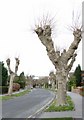
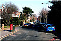
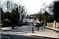
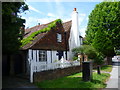
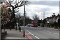
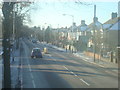
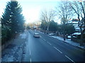
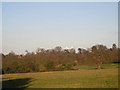
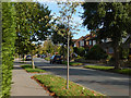
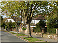
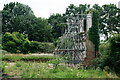
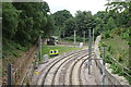
73 photos from this area
Area Information
Key information about the CR0 7LA including its size, population, and administrative classification.
- Area Type
- Postcode
- Area Size
- 1.9 hectares
- Population
- 1440
- Population Density
- 1038 people/km²
House Prices in CR0 7LA
17
Properties
£660,667
Average Sold Price
£331,000
Lowest Price
£955,000
Highest Price
Showing 17 properties
| Address | Type | Beds | Baths | Last Sale Price | Last Sale Date | |
|---|---|---|---|---|---|---|
| 148 Addiscombe Road, Croydon, CR0 7LA | house | - | - | £955,000 | Mar 2023 | |
| 140 Addiscombe Road, Croydon, CR0 7LA | Detached | 4 | 2 | £935,000 | May 2021 | |
| 166 Addiscombe Road, Croydon, CR0 7LA | Detached | 6 | 2 | £900,000 | Oct 2020 | |
| 144 Addiscombe Road, Croydon, CR0 7LA | Bungalow | 5 | 4 | £750,000 | Apr 2018 | |
| 146 Addiscombe Road, Croydon, CR0 7LA | Detached | 4 | - | £700,000 | May 2017 | |
| 142 Addiscombe Road, Croydon, CR0 7LA | Detached | 4 | 1 | £615,000 | Oct 2014 | |
| 136 Addiscombe Road, Croydon, CR0 7LA | house | - | - | £380,000 | Mar 2005 | |
| 162 Addiscombe Road, Croydon, CR0 7LA | Detached | - | - | £380,000 | Jun 2002 | |
| 160 Addiscombe Road, Croydon, CR0 7LA | Detached | 2 | 1 | £331,000 | Feb 2002 | |
| 138 Addiscombe Road, Croydon, CR0 7LA | Detached | 4 | 1 | - | - |
Page 1 of 2
Energy Efficiency in CR0 7LA
Amenities
Schools
| Rank | School | Type | Entry gender | Ages |
|---|
Explore more schools in this area
Go to Schools tabDemographics
Household Size
Family (3-5 people)
most common
Accommodation Type
Houses
most common
Tenure
81
majority
Ethnic Group
asian_total
most common
Religion
N/A
most common
Household Composition
N/A
most common
Age
47
median
Adults (30-64 years)
most common
Household Deprivation
N/A
with no deprivation
NS-SEC
53
in Lower managerial occupations
Explore more demographic insights in this area
Go to Demographics tabPlanning
Planning Constraints
- Flood RiskPremium
- Ramsar Wetland SitesPremium
- Area of Outstanding Natural BeautyPremium
- Protected Nature ReservePremium
- Protected WoodlandPremium