Area Overview for CR0 6TS
Photos of CR0 6TS
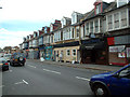
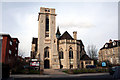
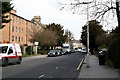
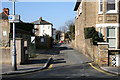
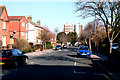
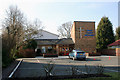
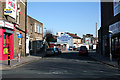
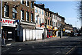
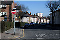
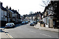
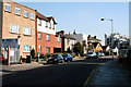
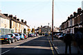
100 photos from this area
Area Information
Key information about the CR0 6TS including its size, population, and administrative classification.
- Area Type
- Postcode
- Area Size
- 5377 m²
- Population
- Not available
- Population Density
- Not available
House Prices in CR0 6TS
28
Properties
£361,238
Average Sold Price
£67,500
Lowest Price
£545,000
Highest Price
Showing 28 properties
| Address | Type | Beds | Baths | Last Sale Price | Last Sale Date | |
|---|---|---|---|---|---|---|
| 82 Addiscombe Court Road, Croydon, CR0 6TS | Terraced | 3 | 2 | £540,000 | Aug 2025 | |
| 74 Addiscombe Court Road, Croydon, CR0 6TS | Terraced | 4 | 2 | £530,000 | Mar 2025 | |
| 98 Addiscombe Court Road, Croydon, CR0 6TS | Detached | 3 | 1 | £435,000 | Feb 2025 | |
| 86 Addiscombe Court Road, Croydon, CR0 6TS | Terraced | 3 | 1 | £470,000 | Mar 2023 | |
| 128 Addiscombe Court Road, Croydon, CR0 6TS | Retail | 3 | 1 | £485,000 | Aug 2022 | |
| 102 Addiscombe Court Road, Croydon, CR0 6TS | house | - | - | £445,000 | Dec 2020 | |
| 122 Addiscombe Court Road, Croydon, CR0 6TS | Terraced | 4 | 2 | £493,500 | Dec 2018 | |
| 90 Addiscombe Court Road, Croydon, CR0 6TS | Terraced | 3 | - | £495,000 | Oct 2018 | |
| 78 Addiscombe Court Road, Croydon, CR0 6TS | Terraced | 4 | 3 | £520,000 | Sep 2018 | |
| 72 Addiscombe Court Road, Croydon, CR0 6TS | Terraced | 1 | 1 | £545,000 | Apr 2018 |
Page 1 of 3
Energy Efficiency in CR0 6TS
Amenities
Schools
| Rank | School | Type | Entry gender | Ages |
|---|
Explore more schools in this area
Go to Schools tabDemographics
Household Size
Two person
most common
Accommodation Type
Houses
most common
Tenure
46
majority
Ethnic Group
White
most common
Religion
N/A
most common
Household Composition
N/A
most common
Age
47
median
Adults (30-64 years)
most common
Household Deprivation
N/A
with no deprivation
NS-SEC
42
in Lower managerial occupations
Explore more demographic insights in this area
Go to Demographics tabPlanning
Planning Constraints
- Flood RiskPremium
- Ramsar Wetland SitesPremium
- Area of Outstanding Natural BeautyPremium
- Protected Nature ReservePremium
- Protected WoodlandPremium