Area Overview for CR0 6QW
Photos of CR0 6QW
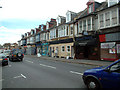
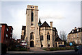
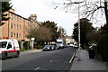
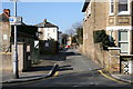
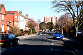
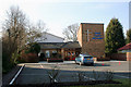
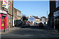
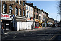
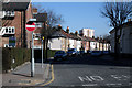
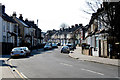
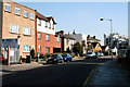
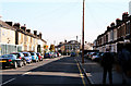
100 photos from this area
Area Information
Key information about the CR0 6QW including its size, population, and administrative classification.
- Area Type
- Postcode
- Area Size
- 5488 m²
- Population
- 1943
- Population Density
- 11225 people/km²
House Prices in CR0 6QW
45
Properties
£307,969
Average Sold Price
£55,950
Lowest Price
£1,010,000
Highest Price
Showing 45 properties
| Address | Type | Beds | Baths | Last Sale Price | Last Sale Date | |
|---|---|---|---|---|---|---|
| 7C Inglis Road, Croydon, CR0 6QW | Flat | 2 | 1 | £267,000 | Feb 2025 | |
| 23 Inglis Road, Croydon, CR0 6QW | Detached | 4 | 3 | £1,010,000 | Dec 2023 | |
| 5A Inglis Road, Croydon, CR0 6QW | Flat | 2 | - | £346,000 | Nov 2022 | |
| 19 Inglis Road, Croydon, CR0 6QW | Flat | - | - | £355,000 | Aug 2021 | |
| 17 Inglis Road, Croydon, CR0 6QW | house | - | - | £380,000 | Jan 2021 | |
| 1A Inglis Road, Croydon, CR0 6QW | Flat | 2 | - | £335,000 | Sep 2020 | |
| 33 Inglis Road, Croydon, CR0 6QW | Semi-detached | 4 | 2 | £490,000 | Oct 2019 | |
| 5 Inglis Road, Croydon, CR0 6QW | Maisonette | 2 | - | £318,000 | Sep 2019 | |
| 21 Inglis Road, Croydon, CR0 6QW | Semi-detached | - | - | £272,000 | Jun 2014 | |
| 7B Inglis Road, Croydon, CR0 6QW | Flat | - | - | £140,000 | Jul 2013 |
Page 1 of 5
Energy Efficiency in CR0 6QW
Amenities
Schools
| Rank | School | Type | Entry gender | Ages |
|---|
Explore more schools in this area
Go to Schools tabDemographics
Household Size
One person
most common
Accommodation Type
Flats
most common
Tenure
34
majority
Ethnic Group
White
most common
Religion
N/A
most common
Household Composition
N/A
most common
Age
47
median
Adults (30-64 years)
most common
Household Deprivation
N/A
with no deprivation
NS-SEC
32
in Lower managerial occupations
Explore more demographic insights in this area
Go to Demographics tabPlanning
Planning Constraints
- Flood RiskPremium
- Ramsar Wetland SitesPremium
- Area of Outstanding Natural BeautyPremium
- Protected Nature ReservePremium
- Protected WoodlandPremium