Area Overview for CR0 6DB
Photos of CR0 6DB
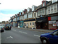
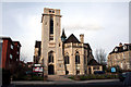
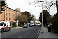
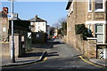
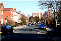
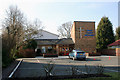
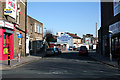
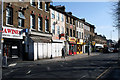
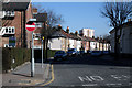
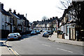
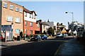
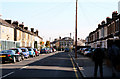
100 photos from this area
Area Information
Key information about the CR0 6DB including its size, population, and administrative classification.
- Area Type
- Postcode
- Area Size
- 7413 m²
- Population
- 2140
- Population Density
- 13099 people/km²
House Prices in CR0 6DB
41
Properties
£292,219
Average Sold Price
£76,000
Lowest Price
£507,500
Highest Price
Showing 41 properties
| Address | Type | Beds | Baths | Last Sale Price | Last Sale Date | |
|---|---|---|---|---|---|---|
| 100 Davidson Road, Croydon, CR0 6DB | Terraced | 4 | 1 | £507,500 | Oct 2025 | |
| 80 Davidson Road, Croydon, CR0 6DB | Terraced | 2 | 2 | £360,000 | Aug 2025 | |
| 26 Davidson Road, Croydon, CR0 6DB | Terraced | 2 | 1 | £370,000 | Nov 2024 | |
| 70 Davidson Road, Croydon, CR0 6DB | Terraced | 2 | 1 | £375,000 | Apr 2024 | |
| 34 Davidson Road, Croydon, CR0 6DB | Terraced | 3 | 1 | £395,000 | Jul 2023 | |
| 54 Davidson Road, Croydon, CR0 6DB | Semi-detached | 3 | 1 | £504,000 | Nov 2022 | |
| 24 Davidson Road, Croydon, CR0 6DB | Terraced | 4 | 1 | £400,000 | Jun 2022 | |
| 74 Davidson Road, Croydon, CR0 6DB | house | - | - | £335,000 | Jun 2021 | |
| 96 Davidson Road, Croydon, CR0 6DB | house | - | - | £408,500 | Apr 2021 | |
| 32 Davidson Road, Croydon, CR0 6DB | Terraced | 3 | 1 | £351,650 | Feb 2017 |
Page 1 of 5
Energy Efficiency in CR0 6DB
Amenities
Schools
| Rank | School | Type | Entry gender | Ages |
|---|
Explore more schools in this area
Go to Schools tabDemographics
Household Size
Family (3-5 people)
most common
Accommodation Type
Houses
most common
Tenure
39
majority
Ethnic Group
White
most common
Religion
N/A
most common
Household Composition
N/A
most common
Age
47
median
Adults (30-64 years)
most common
Household Deprivation
N/A
with no deprivation
NS-SEC
34
in Lower managerial occupations
Explore more demographic insights in this area
Go to Demographics tabPlanning
Planning Constraints
- Flood RiskPremium
- Ramsar Wetland SitesPremium
- Area of Outstanding Natural BeautyPremium
- Protected Nature ReservePremium
- Protected WoodlandPremium