Area Overview for CR0 6AB
Photos of CR0 6AB
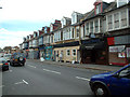
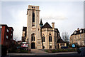
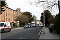
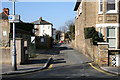
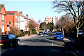
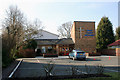
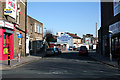
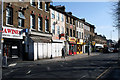
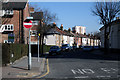
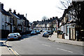
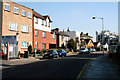
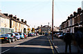
100 photos from this area
Area Information
Key information about the CR0 6AB including its size, population, and administrative classification.
- Area Type
- Postcode
- Area Size
- 8709 m²
- Population
- Not available
- Population Density
- Not available
House Prices in CR0 6AB
77
Properties
£224,000
Average Sold Price
£67,000
Lowest Price
£400,000
Highest Price
Showing 77 properties
| Address | Type | Beds | Baths | Last Sale Price | Last Sale Date | |
|---|---|---|---|---|---|---|
| 70A Lower Addiscombe Road, Croydon, CR0 6AB | Flat | - | - | £185,000 | Mar 2025 | |
| 76A Lower Addiscombe Road, Croydon, CR0 6AB | Flat | 2 | - | £400,000 | May 2024 | |
| 96C Lower Addiscombe Road, Croydon, CR0 6AB | Maisonette | 1 | 1 | £240,000 | Feb 2024 | |
| 96A Lower Addiscombe Road, Croydon, CR0 6AB | Flat | 1 | 1 | £228,000 | Nov 2022 | |
| 96B Lower Addiscombe Road, Croydon, CR0 6AB | Flat | - | - | £67,000 | Feb 1997 | |
| 92C Lower Addiscombe Road, Croydon, CR0 6AB | Flat | - | - | - | - | |
| 92D Lower Addiscombe Road, Croydon, CR0 6AB | Flat | - | - | - | - | |
| 92B Lower Addiscombe Road, Croydon, CR0 6AB | Flat | - | - | - | - | |
| 94 Lower Addiscombe Road, Croydon, CR0 6AB | Flat | - | 1 | - | - | |
| Second Third And Fourth Floor Maisonette, 80 Lower Addiscombe Road, Croydon, CR0 6AB | Flat | 3 | 1 | - | - |
Page 1 of 8
Energy Efficiency in CR0 6AB
Amenities
Schools
| Rank | School | Type | Entry gender | Ages |
|---|
Explore more schools in this area
Go to Schools tabDemographics
Household Size
Two person
most common
Accommodation Type
Flats
most common
Tenure
42
majority
Ethnic Group
White
most common
Religion
N/A
most common
Household Composition
N/A
most common
Age
47
median
Adults (30-64 years)
most common
Household Deprivation
N/A
with no deprivation
NS-SEC
45
in Lower managerial occupations
Explore more demographic insights in this area
Go to Demographics tabPlanning
Planning Constraints
- Flood RiskPremium
- Ramsar Wetland SitesPremium
- Area of Outstanding Natural BeautyPremium
- Protected Nature ReservePremium
- Protected WoodlandPremium