Area Overview for CR0 5ER
Photos of CR0 5ER
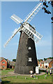
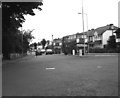
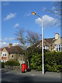
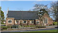

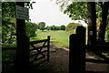

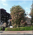
75 photos from this area
Area Information
Key information about the CR0 5ER including its size, population, and administrative classification.
- Area Type
- Postcode
- Area Size
- 3831 m²
- Population
- Not available
- Population Density
- Not available
House Prices in CR0 5ER
20
Properties
£324,827
Average Sold Price
£95,000
Lowest Price
£477,000
Highest Price
Showing 20 properties
| Address | Type | Beds | Baths | Last Sale Price | Last Sale Date | |
|---|---|---|---|---|---|---|
| 7 Barmouth Road, Croydon, CR0 5ER | Terraced | 2 | - | £390,000 | Jul 2021 | |
| 1 Barmouth Road, Croydon, CR0 5ER | Terraced | 3 | 1 | £439,500 | Aug 2020 | |
| 23 Barmouth Road, Croydon, CR0 5ER | Terraced | 3 | 1 | £445,000 | Oct 2019 | |
| 21 Barmouth Road, Croydon, CR0 5ER | Terraced | 3 | 1 | £477,000 | Sep 2018 | |
| 39 Barmouth Road, Croydon, CR0 5ER | house | - | - | £400,000 | Feb 2017 | |
| 29 Barmouth Road, Croydon, CR0 5ER | house | - | - | £435,000 | Jul 2016 | |
| 5 Barmouth Road, Croydon, CR0 5ER | Terraced | 2 | - | £330,000 | Sep 2015 | |
| 19 Barmouth Road, Croydon, CR0 5ER | house | - | - | £325,000 | Mar 2015 | |
| 9 Barmouth Road, Croydon, CR0 5ER | Terraced | - | - | £284,000 | Oct 2007 | |
| 13 Barmouth Road, Croydon, CR0 5ER | Terraced | - | - | £261,250 | Oct 2006 |
Page 1 of 2
Energy Efficiency in CR0 5ER
Amenities
Schools
| Rank | School | Type | Entry gender | Ages |
|---|
Explore more schools in this area
Go to Schools tabDemographics
Household Size
Family (3-5 people)
most common
Accommodation Type
Houses
most common
Tenure
85
majority
Ethnic Group
White
most common
Religion
N/A
most common
Household Composition
N/A
most common
Age
47
median
Adults (30-64 years)
most common
Household Deprivation
N/A
with no deprivation
NS-SEC
42
in Lower managerial occupations
Explore more demographic insights in this area
Go to Demographics tabPlanning
Planning Constraints
- Flood RiskPremium
- Ramsar Wetland SitesPremium
- Area of Outstanding Natural BeautyPremium
- Protected Nature ReservePremium
- Protected WoodlandPremium