Area Overview for CR0 3DH
Photos of CR0 3DH

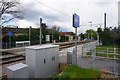
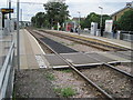
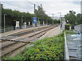
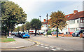
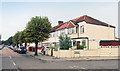

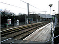
99 photos from this area
Area Information
Key information about the CR0 3DH including its size, population, and administrative classification.
- Area Type
- Postcode
- Area Size
- 3.4 hectares
- Population
- 1630
- Population Density
- 475 people/km²
House Prices in CR0 3DH
42
Properties
£200,496
Average Sold Price
£55,000
Lowest Price
£440,000
Highest Price
Showing 42 properties
| Address | Type | Beds | Baths | Last Sale Price | Last Sale Date | |
|---|---|---|---|---|---|---|
| 26 Therapia Lane, Croydon, CR0 3DH | Terraced | 3 | 1 | £317,500 | Feb 2025 | |
| 24 Therapia Lane, Croydon, CR0 3DH | Terraced | 3 | 1 | £380,000 | Jul 2024 | |
| 14 Therapia Lane, Croydon, CR0 3DH | Terraced | 3 | 1 | £350,000 | Jun 2023 | |
| 30 Therapia Lane, Croydon, CR0 3DH | Terraced | 3 | 1 | £440,000 | Jan 2023 | |
| 34 Therapia Lane, Croydon, CR0 3DH | house | - | - | £327,000 | Mar 2021 | |
| 17 Therapia Lane, Croydon, CR0 3DH | Terraced | 3 | 1 | £318,000 | May 2015 | |
| 29 Therapia Lane, Croydon, CR0 3DH | house | - | - | £222,500 | Dec 2013 | |
| 19A Therapia Lane, Croydon, CR0 3DH | Terraced | 2 | - | £161,000 | Jan 2013 | |
| 27 Therapia Lane, Croydon, CR0 3DH | Terraced | 3 | 2 | £194,000 | Jul 2012 | |
| 5 Therapia Lane, Croydon, CR0 3DH | house | - | - | £195,000 | Aug 2011 |
Page 1 of 5
Energy Efficiency in CR0 3DH
Amenities
Schools
| Rank | School | Type | Entry gender | Ages |
|---|
Explore more schools in this area
Go to Schools tabDemographics
Household Size
Family (3-5 people)
most common
Accommodation Type
Houses
most common
Tenure
65
majority
Ethnic Group
White
most common
Religion
N/A
most common
Household Composition
N/A
most common
Age
47
median
Adults (30-64 years)
most common
Household Deprivation
N/A
with no deprivation
NS-SEC
31
in Lower managerial occupations
Explore more demographic insights in this area
Go to Demographics tabPlanning
Planning Constraints
- Flood RiskPremium
- Ramsar Wetland SitesPremium
- Area of Outstanding Natural BeautyPremium
- Protected Nature ReservePremium
- Protected WoodlandPremium