Area Overview for CR0 2HN
Photos of CR0 2HN

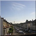


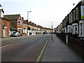


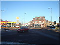
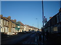

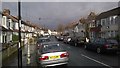

100 photos from this area
Area Information
Key information about the CR0 2HN including its size, population, and administrative classification.
- Area Type
- Postcode
- Area Size
- 3.2 hectares
- Population
- Not available
- Population Density
- Not available
House Prices in CR0 2HN
73
Properties
£248,000
Average Sold Price
£84,000
Lowest Price
£800,000
Highest Price
Showing 73 properties
| Address | Type | Beds | Baths | Last Sale Price | Last Sale Date | |
|---|---|---|---|---|---|---|
| 13 The Crescent, Croydon, CR0 2HN | Semi-detached | 5 | 2 | £800,000 | Jul 2024 | |
| 17 The Crescent, Croydon, CR0 2HN | Flat | 2 | 1 | £210,000 | Dec 2023 | |
| 15 The Crescent, Croydon, CR0 2HN | house | 1 | 1 | £470,000 | Nov 2016 | |
| Flat 2, 37 The Crescent, Croydon, CR0 2HN | Flat | - | - | £220,000 | Oct 2016 | |
| Flat 1, 37 The Crescent, Croydon, CR0 2HN | Flat | - | - | £250,000 | Oct 2016 | |
| Flat 3, 37 The Crescent, Croydon, CR0 2HN | Flat | - | - | £250,000 | Oct 2016 | |
| 1A The Crescent, Croydon, CR0 2HN | Flat | - | - | £249,999 | Aug 2007 | |
| 43 The Crescent, Croydon, CR0 2HN | Terraced | - | - | £336,500 | Mar 2006 | |
| 1B The Crescent, Croydon, CR0 2HN | Maisonette | - | - | £84,000 | Oct 2001 | |
| 45 The Crescent, Croydon, CR0 2HN | Terraced | - | - | £184,000 | May 2001 |
Page 1 of 8
Energy Efficiency in CR0 2HN
Amenities
Schools
| Rank | School | Type | Entry gender | Ages |
|---|
Explore more schools in this area
Go to Schools tabDemographics
Household Size
Family (3-5 people)
most common
Accommodation Type
Flats
most common
Tenure
35
majority
Ethnic Group
black_total
most common
Religion
N/A
most common
Household Composition
N/A
most common
Age
47
median
Adults (30-64 years)
most common
Household Deprivation
N/A
with no deprivation
NS-SEC
23
in Lower managerial occupations
Explore more demographic insights in this area
Go to Demographics tabPlanning
Planning Constraints
- Flood RiskPremium
- Ramsar Wetland SitesPremium
- Area of Outstanding Natural BeautyPremium
- Protected Nature ReservePremium
- Protected WoodlandPremium