Area Overview for CR0 1AZ
Photos of CR0 1AZ
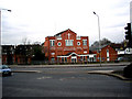
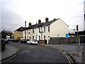
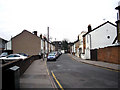
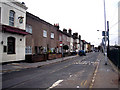
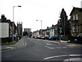
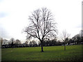
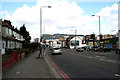
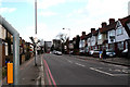
100 photos from this area
Area Information
Key information about the CR0 1AZ including its size, population, and administrative classification.
- Area Type
- Postcode
- Area Size
- 1.0 hectares
- Population
- 2172
- Population Density
- 10412 people/km²
House Prices in CR0 1AZ
30
Properties
£256,116
Average Sold Price
£52,000
Lowest Price
£465,000
Highest Price
Showing 30 properties
| Address | Type | Beds | Baths | Last Sale Price | Last Sale Date | |
|---|---|---|---|---|---|---|
| 20 Howley Road, Croydon, CR0 1AZ | Terraced | 2 | 1 | £370,000 | Feb 2024 | |
| 14 Howley Road, Croydon, CR0 1AZ | Terraced | 2 | 1 | £357,200 | Nov 2023 | |
| 48 Howley Road, Croydon, CR0 1AZ | house | - | - | £380,000 | Sep 2023 | |
| 26 Howley Road, Croydon, CR0 1AZ | Terraced | 2 | 1 | £396,000 | Jun 2023 | |
| 40 Howley Road, Croydon, CR0 1AZ | Terraced | 2 | 1 | £465,000 | Dec 2022 | |
| 32 Howley Road, Croydon, CR0 1AZ | Terraced | 1 | 1 | £400,000 | Jul 2022 | |
| 28 Howley Road, Croydon, CR0 1AZ | Terraced | 2 | 2 | £420,000 | Jun 2022 | |
| 12 Howley Road, Croydon, CR0 1AZ | Terraced | 2 | 1 | £320,000 | Jun 2019 | |
| 22 Howley Road, Croydon, CR0 1AZ | Terraced | 2 | - | £335,000 | Oct 2016 | |
| 18 Howley Road, Croydon, CR0 1AZ | Terraced | 2 | - | £225,000 | Sep 2013 |
Page 1 of 3
Energy Efficiency in CR0 1AZ
Amenities
Schools
| Rank | School | Type | Entry gender | Ages |
|---|
Explore more schools in this area
Go to Schools tabDemographics
Household Size
Two person
most common
Accommodation Type
Flats
most common
Tenure
36
majority
Ethnic Group
White
most common
Religion
N/A
most common
Household Composition
N/A
most common
Age
47
median
Adults (30-64 years)
most common
Household Deprivation
N/A
with no deprivation
NS-SEC
35
in Lower managerial occupations
Explore more demographic insights in this area
Go to Demographics tabPlanning
Planning Constraints
- Flood RiskPremium
- Ramsar Wetland SitesPremium
- Area of Outstanding Natural BeautyPremium
- Protected Nature ReservePremium
- Protected WoodlandPremium