Area Overview for CR0 1AB
Photos of CR0 1AB
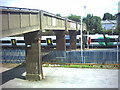
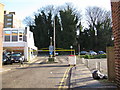
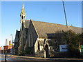
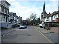
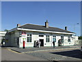
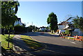
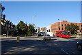
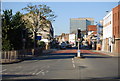
100 photos from this area
Area Information
Key information about the CR0 1AB including its size, population, and administrative classification.
- Area Type
- Postcode
- Area Size
- 3588 m²
- Population
- 1625
- Population Density
- 13542 people/km²
House Prices in CR0 1AB
24
Properties
£224,825
Average Sold Price
£160,000
Lowest Price
£400,000
Highest Price
Showing 24 properties
| Address | Type | Beds | Baths | Last Sale Price | Last Sale Date | |
|---|---|---|---|---|---|---|
| 14B St Andrews Road, Croydon, CR0 1AB | Maisonette | 2 | 2 | £400,000 | Oct 2020 | |
| 11 St Andrews Road, Croydon, CR0 1AB | Terraced | 2 | - | £182,000 | Aug 2013 | |
| 16 St Andrews Road, Croydon, CR0 1AB | house | - | - | £160,000 | Apr 2009 | |
| 12 St Andrews Road, Croydon, CR0 1AB | house | - | - | £220,000 | Aug 2007 | |
| 10 St Andrews Road, Croydon, CR0 1AB | Terraced | - | - | £226,950 | May 2007 | |
| 6 St Andrews Road, Croydon, CR0 1AB | house | 1 | 1 | £160,000 | Jun 2003 | |
| Flat 5, Lion Head Court, 17 St Andrews Road, Croydon, CR0 1AB | Flat | 1 | 1 | - | - | |
| Flat 1, Lion Head Court, 17 St Andrews Road, Croydon, CR0 1AB | Flat | 1 | 1 | - | - | |
| 14A St Andrews Road, Croydon, CR0 1AB | Maisonette | 1 | 1 | - | - | |
| 9 St Andrews Road, Croydon, CR0 1AB | Terraced | 5 | 2 | - | - |
Page 1 of 3
Energy Efficiency in CR0 1AB
Amenities
Schools
| Rank | School | Type | Entry gender | Ages |
|---|
Explore more schools in this area
Go to Schools tabDemographics
Household Size
One person
most common
Accommodation Type
Flats
most common
Tenure
33
majority
Ethnic Group
White
most common
Religion
N/A
most common
Household Composition
N/A
most common
Age
47
median
Adults (30-64 years)
most common
Household Deprivation
N/A
with no deprivation
NS-SEC
33
in Lower managerial occupations
Explore more demographic insights in this area
Go to Demographics tabPlanning
Planning Constraints
- Flood RiskPremium
- Ramsar Wetland SitesPremium
- Area of Outstanding Natural BeautyPremium
- Protected Nature ReservePremium
- Protected WoodlandPremium