Area Overview for CR0 0JE
Photos of CR0 0JE

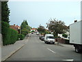
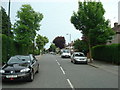
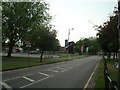
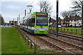
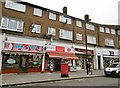
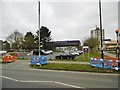

55 photos from this area
Area Information
Key information about the CR0 0JE including its size, population, and administrative classification.
- Area Type
- Postcode
- Area Size
- 1.7 hectares
- Population
- 1332
- Population Density
- 7323 people/km²
House Prices in CR0 0JE
69
Properties
£266,165
Average Sold Price
£71,500
Lowest Price
£495,000
Highest Price
Showing 69 properties
| Address | Type | Beds | Baths | Last Sale Price | Last Sale Date | |
|---|---|---|---|---|---|---|
| 80 Montacute Road, Croydon, CR0 0JE | Detached | 2 | 1 | £310,000 | Apr 2024 | |
| 42 Montacute Road, Croydon, CR0 0JE | Semi-detached | 3 | 2 | £420,000 | Aug 2023 | |
| 4 Montacute Road, Croydon, CR0 0JE | Semi-detached | 2 | 1 | £365,000 | Dec 2022 | |
| 78 Montacute Road, Croydon, CR0 0JE | Semi-detached | 4 | 1 | £495,000 | Sep 2022 | |
| 46 Montacute Road, Croydon, CR0 0JE | Semi-detached | 3 | 2 | £375,000 | Sep 2019 | |
| 22 Montacute Road, Croydon, CR0 0JE | Semi-detached | 3 | 1 | £356,000 | Dec 2018 | |
| 86 Montacute Road, Croydon, CR0 0JE | Semi-detached | 2 | 1 | £320,000 | Aug 2017 | |
| 90 Montacute Road, Croydon, CR0 0JE | Semi-detached | 4 | 1 | £378,000 | Apr 2017 | |
| 20 Montacute Road, Croydon, CR0 0JE | Semi-detached | 3 | 1 | £370,000 | Sep 2016 | |
| 10 Montacute Road, Croydon, CR0 0JE | Detached | 3 | 1 | £339,950 | Mar 2016 |
Page 1 of 7
Energy Efficiency in CR0 0JE
Amenities
Schools
| Rank | School | Type | Entry gender | Ages |
|---|
Explore more schools in this area
Go to Schools tabDemographics
Household Size
Family (3-5 people)
most common
Accommodation Type
Houses
most common
Tenure
77
majority
Ethnic Group
White
most common
Religion
N/A
most common
Household Composition
N/A
most common
Age
47
median
Adults (30-64 years)
most common
Household Deprivation
N/A
with no deprivation
NS-SEC
30
in Lower managerial occupations
Explore more demographic insights in this area
Go to Demographics tabPlanning
Planning Constraints
- Flood RiskPremium
- Ramsar Wetland SitesPremium
- Area of Outstanding Natural BeautyPremium
- Protected Nature ReservePremium
- Protected WoodlandPremium