Area Overview for CR0 0HD
Photos of CR0 0HD

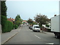
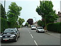

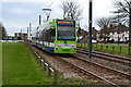


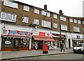
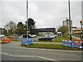

55 photos from this area
Area Information
Key information about the CR0 0HD including its size, population, and administrative classification.
- Area Type
- Postcode
- Area Size
- 2.8 hectares
- Population
- 1551
- Population Density
- 2807 people/km²
House Prices in CR0 0HD
40
Properties
£136,406
Average Sold Price
£38,250
Lowest Price
£230,000
Highest Price
Showing 40 properties
| Address | Type | Beds | Baths | Last Sale Price | Last Sale Date | |
|---|---|---|---|---|---|---|
| 18 Kestrel Way, Croydon, CR0 0HD | Flat | - | - | £220,000 | Dec 2018 | |
| 34 Kestrel Way, Croydon, CR0 0HD | Maisonette | 2 | - | £230,000 | Oct 2018 | |
| 33 Kestrel Way, Croydon, CR0 0HD | Maisonette | - | - | £150,000 | Mar 2015 | |
| 25 Kestrel Way, Croydon, CR0 0HD | Flat | 2 | 1 | £130,000 | Sep 2013 | |
| 30 Kestrel Way, Croydon, CR0 0HD | Maisonette | 2 | 1 | £125,000 | Jul 2012 | |
| 19 Kestrel Way, Croydon, CR0 0HD | Flat | - | - | £96,000 | Aug 2005 | |
| 28 Kestrel Way, Croydon, CR0 0HD | Maisonette | 2 | 1 | £102,000 | Sep 2002 | |
| 8 Kestrel Way, Croydon, CR0 0HD | Maisonette | - | - | £38,250 | Sep 1998 | |
| 5 Kestrel Way, Croydon, CR0 0HD | Maisonette | - | - | - | - | |
| 1 Kestrel Way, Croydon, CR0 0HD | Flat | - | - | - | - |
Page 1 of 4
Energy Efficiency in CR0 0HD
Amenities
Schools
| Rank | School | Type | Entry gender | Ages |
|---|
Explore more schools in this area
Go to Schools tabDemographics
Household Size
Family (3-5 people)
most common
Accommodation Type
Houses
most common
Tenure
52
majority
Ethnic Group
White
most common
Religion
N/A
most common
Household Composition
N/A
most common
Age
47
median
Adults (30-64 years)
most common
Household Deprivation
N/A
with no deprivation
NS-SEC
23
in Lower managerial occupations
Explore more demographic insights in this area
Go to Demographics tabPlanning
Planning Constraints
- Flood RiskPremium
- Ramsar Wetland SitesPremium
- Area of Outstanding Natural BeautyPremium
- Protected Nature ReservePremium
- Protected WoodlandPremium