Area Overview for CR0 0HB
Photos of CR0 0HB

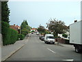
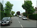
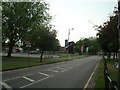
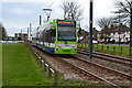
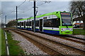
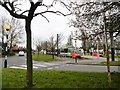
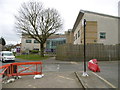
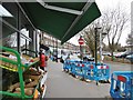
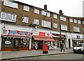
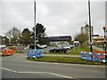
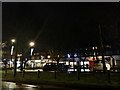
55 photos from this area
Area Information
Key information about the CR0 0HB including its size, population, and administrative classification.
- Area Type
- Postcode
- Area Size
- 9212 m²
- Population
- 1551
- Population Density
- 2807 people/km²
House Prices in CR0 0HB
25
Properties
£235,994
Average Sold Price
£76,000
Lowest Price
£390,000
Highest Price
Showing 25 properties
| Address | Type | Beds | Baths | Last Sale Price | Last Sale Date | |
|---|---|---|---|---|---|---|
| 46 Queen Elizabeths Drive, Croydon, CR0 0HB | house | - | - | £338,000 | May 2024 | |
| 30 Queen Elizabeths Drive, Croydon, CR0 0HB | house | - | - | £390,000 | Sep 2023 | |
| 44 Queen Elizabeths Drive, Croydon, CR0 0HB | Terraced | 3 | 1 | £370,000 | Nov 2021 | |
| 32 Queen Elizabeths Drive, Croydon, CR0 0HB | house | - | - | £355,000 | Dec 2020 | |
| 38 Queen Elizabeths Drive, Croydon, CR0 0HB | Semi-detached | 1 | 2 | £375,000 | Mar 2016 | |
| 10 Queen Elizabeths Drive, Croydon, CR0 0HB | Semi-detached | 3 | 1 | £273,000 | Mar 2015 | |
| 28 Queen Elizabeths Drive, Croydon, CR0 0HB | house | - | - | £223,950 | Sep 2010 | |
| 20 Queen Elizabeths Drive, Croydon, CR0 0HB | house | - | - | £218,000 | May 2008 | |
| 36 Queen Elizabeths Drive, Croydon, CR0 0HB | house | - | - | £240,000 | Dec 2007 | |
| 26 Queen Elizabeths Drive, Croydon, CR0 0HB | house | - | - | £255,000 | Sep 2007 |
Page 1 of 3
Energy Efficiency in CR0 0HB
Amenities
Schools
| Rank | School | Type | Entry gender | Ages |
|---|
Explore more schools in this area
Go to Schools tabDemographics
Household Size
Family (3-5 people)
most common
Accommodation Type
Houses
most common
Tenure
52
majority
Ethnic Group
White
most common
Religion
N/A
most common
Household Composition
N/A
most common
Age
47
median
Adults (30-64 years)
most common
Household Deprivation
N/A
with no deprivation
NS-SEC
23
in Lower managerial occupations
Explore more demographic insights in this area
Go to Demographics tabPlanning
Planning Constraints
- Flood RiskPremium
- Ramsar Wetland SitesPremium
- Area of Outstanding Natural BeautyPremium
- Protected Nature ReservePremium
- Protected WoodlandPremium