Area Overview for CM14 5NL
Photos of CM14 5NL
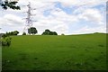
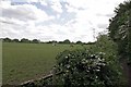
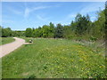
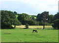
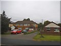
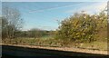
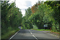
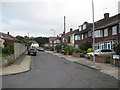
15 photos from this area
Area Information
Key information about the CM14 5NL including its size, population, and administrative classification.
- Area Type
- Postcode
- Area Size
- 57.7 hectares
- Population
- 1696
- Population Density
- 418 people/km²
House Prices in CM14 5NL
29
Properties
£537,333
Average Sold Price
£115,000
Lowest Price
£1,380,000
Highest Price
Showing 29 properties
| Address | Type | Beds | Baths | Last Sale Price | Last Sale Date | |
|---|---|---|---|---|---|---|
| Rosewood House, 48 Nags Head Lane, Brentwood, CM14 5NL | Bungalow | 2 | 1 | £1,380,000 | Aug 2023 | |
| 47 Nags Head Lane, Brentwood, CM14 5NL | Bungalow | - | - | £660,000 | Aug 2021 | |
| 56 Nags Head Lane, Brentwood, CM14 5NL | Semi-detached | 4 | 2 | £640,000 | Feb 2021 | |
| 49 Nags Head Lane, Brentwood, CM14 5NL | Bungalow | - | - | £620,000 | Nov 2020 | |
| 42 Nags Head Lane, Brentwood, CM14 5NL | Detached | 5 | - | £550,000 | Jul 2020 | |
| 41 Nags Head Lane, Brentwood, CM14 5NL | Detached | 4 | 2 | £830,000 | Sep 2019 | |
| 46 Nags Head Lane, Brentwood, CM14 5NL | Detached | 4 | 2 | £650,000 | Jul 2019 | |
| 44 Nags Head Lane, Brentwood, CM14 5NL | Detached | 2 | 3 | £760,000 | Jun 2019 | |
| 39 Nags Head Lane, Brentwood, CM14 5NL | Detached | 4 | 2 | £700,000 | Aug 2017 | |
| 43 Nags Head Lane, Brentwood, CM14 5NL | Detached | 4 | 2 | £700,000 | Nov 2016 |
Page 1 of 3
Energy Efficiency in CM14 5NL
Amenities
Schools
| Rank | School | Type | Entry gender | Ages |
|---|
Explore more schools in this area
Go to Schools tabDemographics
Household Size
Family (3-5 people)
most common
Accommodation Type
Houses
most common
Tenure
83
majority
Ethnic Group
White
most common
Religion
N/A
most common
Household Composition
N/A
most common
Age
47
median
Adults (30-64 years)
most common
Household Deprivation
N/A
with no deprivation
NS-SEC
35
in Lower managerial occupations
Explore more demographic insights in this area
Go to Demographics tabPlanning
Planning Constraints
- Flood RiskPremium
- Ramsar Wetland SitesPremium
- Area of Outstanding Natural BeautyPremium
- Protected Nature ReservePremium
- Protected WoodlandPremium