Area Overview for Clayhall Ward
Photos of Clayhall Ward
Area Information
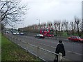
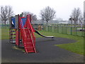
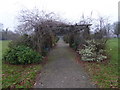
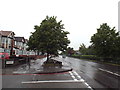
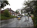
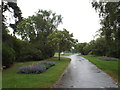
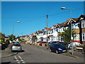
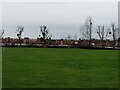
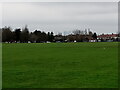
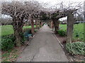
Clayhall Ward represents a distinct suburban enclave within the London Borough of Redbridge, covering just 2.5 square kilometres. This compact area is home to 1,858 residents, creating a population density of 733 people per square kilometre. You are looking at a neighbourhood that evolved from an ancient manor, first appearing in historical records around 1203. By 1410, it was established as the manor of Clayhall, passing through various families including the de la Claie lineage before Sir Christopher Hatton took residence in the 17th century. The manor house itself fell during the mid-18th century and was replaced by a farmhouse on land managed by tenant farmers until the estate was broken up for building in 1935. Daily life in Clayhall Ward centres on established community facilities rather than fast-paced urban energy. The area contains Clayhall Park, a significant feature of Longwood Gardens and one of Ilford's largest open spaces. You will find extensive recreational options here, including a bowling green, two dedicated children's play areas, and tennis courts. A small community library operated by Vision RCL serves residents as part of the Redbridge Libraries network. Nearby settlement points include the Clayhall Synagogue, which was formally established around 1993. Living in this ward means accessing historic roots and modern suburban amenities within a defined, manageable geographic boundary.
- Area Type
- District Borough Unitary Ward
- Area Size
- 2.5 km²
- Population
- 1858
- Population Density
- 733 people/km²
Demographics
The community profile of Clayhall Ward is defined by advanced age and high residential stability. The median age in this area is 70 years, which places the neighbourhood significantly older than the rest of London. While specific age range breakdowns are not detailed in the available records, the high median suggests a retirement population dominates the local demography. Home ownership stands at 75 per cent, indicating that most households own their property outright or with a mortgage, rather than renting. This high ownership rate aligns with the area's demographic profile, where older residents often possess established equity. You should expect a traditional household structure given the population characteristics, though detailed data on specific family composition or single-person households are not provided. The area shows no signs of a younger, transient population typically found in student or commuter hubs. Seven out of every ten residents own their homes, which contributes to a stable environment where long-term influence is common. The ethnic composition, predominant religious affiliation, and specific accommodation type classifications are not itemised in the current dataset, but the overarching picture points toward a settled, owner-occupied community. Deprivation indicators are absent from the provided records, so any assessment of quality of life must rely on the high ownership stats and the presence of extensive green spaces like Clayhall Park.
Household Size
Accommodation Type
Tenure
Ethnic Group
Religion
Household Composition
Age
Household Deprivation
NS-SEC
Explore more demographic insights in this area
Go to Demographics tabPlanning
Planning Constraints
- Flood RiskPremium
- Ramsar Wetland SitesPremium
- Area of Outstanding Natural BeautyPremium
- Protected Nature ReservePremium
- Protected WoodlandPremium
- Crime RiskPremium