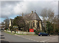
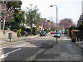
Area Overview for Chiswick Riverside Ward
Photos of Chiswick Riverside Ward


Area Information
Living in Chiswick Riverside Ward offers a distinct experience defined by its compact size and specific location within the borough. You will find this ward covers just 1.2 km² of land, creating a dense neighbourhood where every footstep brings you closer to local amenities. The area cuts across the river, bridging Chiswick and Fulham with homes that overlook the water. This proximity to the Thames means your daily life is shaped by riverside views and water-based transport links such as the river bus service. While the ward is small, it functions as a self-contained community where residents often know their neighbours. Living here means walking to local shops, enjoying a quiet morning by the water, and being close to major roads like the A4. The ward does not stretch far enough to be a sprawling suburb, so your commute begins with a short journey. You will live in a setting where the natural landscape of the river meets urban life, offering a balanced environment for those who prioritise location over space.
- Area Type
- District Borough Unitary Ward
- Area Size
- 1.2 km²
- Population
- Not available
- Population Density
- Not available
Demographics
The community in Chiswick Riverside Ward is defined by an exceptionally mature population, with a median age of 70. You will find that the area predominantly houses older adults, creating a neighbourhood character distinct from younger residential zones. Around 51% of residents own their homes outright or with a mortgage, indicating a strong base of homeowners rather than long-term tenants. This ownership rate suggests stability within the ward, as many residents plan to remain in their properties for the long term. The household composition reflects this age profile, with fewer young families looking for starter homes in this specific location. As you explore Chiswick Riverside Ward, you will encounter residents who have put down roots decades ago. The diversity of the area is evident in the total population breakdown, though the dominant age group shapes the social fabric. You will see a community focused on retirement living, with local services likely catering to this demographic need. This reinforces the quiet, settled nature of the ward, where neighbours often have known one another for generations.
Household Size
Accommodation Type
Tenure
Ethnic Group
Religion
Household Composition
Age
Household Deprivation
NS-SEC
Explore more demographic insights in this area
Go to Demographics tabPlanning
Planning Constraints
- Flood RiskPremium
- Ramsar Wetland SitesPremium
- Area of Outstanding Natural BeautyPremium
- Protected Nature ReservePremium
- Protected WoodlandPremium
- Crime RiskPremium