Area Overview for Chislehurst Ward
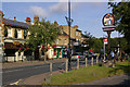
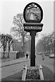
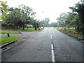
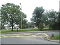
Photos of Chislehurst Ward


Area Information
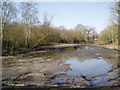
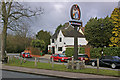
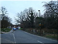
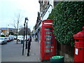
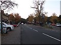
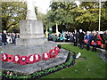
Chislehurst Ward is a defined district within the London Borough of Bromley, covering an area of 10.0 square kilometres. The local population stands at 3,188 residents, creating a relatively small residential footprint compared to wider London suburbs. You will find this ward situated approximately 10 miles south-east of Charing Cross, positioned east of Bromley, south-west of Sidcup, and north-west of Orpington. The location sits at coordinates around 51.412°N 0.075°E, placing it firmly within the historic boundaries of the BR7 postcode district. This specific ward encompasses the broader Chislehurst community, which held a total population of about 15,600 in the 2021 census, though the electoral ward itself records a smaller figure. The area carries significant historical weight, having been a royal manor from medieval times and holding a name meaning the wood where the ground is gravelly since a charter in 973. Today, daily life centres around the preservation of Chislehurst Commons, an 180-acre site managed under the 1888 Metropolitan Commons Act. You can walk to the Prince Imperial monument from 1881 or view the war memorial established in 1920. Living in this area involves engaging with spaces that retain their distinct character while remaining accessible from central London.
- Area Type
- District Borough Unitary Ward
- Area Size
- 10.0 km²
- Population
- 3188
- Population Density
- 318 people/km²
Demographics
The community character of Chislehurst Ward is defined by a notably older resident base. The median age across the ward is 70 years, marking it as a mature demographic environment. This contrasts sharply with many other suburban growth areas in Greater London. While specific breakdowns for age ranges are not detailed to the individual bands, the overarching age profile suggests a neighbourhood built for later life rather than families with young children. Households in Chislehurst Ward show a strong preference for ownership, with 77% of residents owning their homes outright or with a mortgage. This high rate of home ownership indicates stability and long-term roots within the community. Accommodation types and predominant ethnic groups are recorded as total, suggesting that the specific data for these categories does not break down into granular subgroups in the available records. You should expect a neighbourhood where long-term residents dominate the streets. Deprivation levels are not specified in the current records, but the high ownership rate implies a level of settlement typical of established suburbs. If you are considering living in Chislehurst Ward, understand that the social fabric centres on permanence and an older way of life.
Household Size
Accommodation Type
Tenure
Ethnic Group
Religion
Household Composition
Age
Household Deprivation
NS-SEC
Explore more demographic insights in this area
Go to Demographics tabPlanning
Planning Constraints
- Flood RiskPremium
- Ramsar Wetland SitesPremium
- Area of Outstanding Natural BeautyPremium
- Protected Nature ReservePremium
- Protected WoodlandPremium
- Crime RiskPremium