Area Overview for Cheap Ward
Photos of Cheap Ward


Area Information
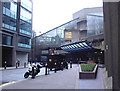
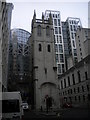
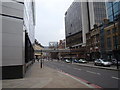
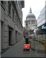
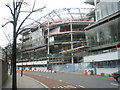
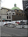
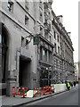
Living in Cheap Ward places you at the very heart of the City of London, within a district defined by its deep historical roots and central location. This ward, which covers just 9.2 hectares, is one of the smallest electoral divisions in England, yet it commands a significant historical presence stretching from King Edward Street to Old Jewry. The area takes its name from the historic West Cheping market, a commercial hub that first appeared in John Stow's 1603 Survey of London. Today, that legacy endures through Cheapside, the ward's main high street and a vital east-west thoroughfare running from the Great Conduit near Old Jewry towards St. Paul's Cathedral. Residents navigate a landscape dotted with historic churches such as St. Mildred's in the Poultry, St. Swithin's, St. Pancras, and St. Lawrence in the Jury. While you are surrounded by ancient lanes like Needlers Lane, Sopars Lane, and Ironmongers Lane, your actual living situation is heavily constrained by the nature of the City of London itself. The Square Mile operates as a global financial district, meaning the population shifts dramatically between business hours and evenings. You are purchasing a place in a location where the party stops when the banks do, creating a distinct rhythm to daily life that differs from typical London suburbs.
- Area Type
- District Borough Unitary Ward
- Area Size
- 9.2 hectares
- Population
- Not available
- Population Density
- Not available
Demographics
The community makeup of Cheap Ward reflects the intensity of life within the Square Mile. Because the ward functions as a central business district, the residential population is subtle and often transient compared to other London boroughs. Available data contains no specific population figures or age breakdowns for Cheap Ward, so you cannot rely on statistics regarding the typical age profile or household types in your new home. In many parts of the City, residents tend to be young professionals or investors with second homes, often spending their nights elsewhere. There is also no specific data provided regarding home ownership levels, the ratio of residents to non-residents, or the diversity statistics for this specific electoral ward. Without these figures, it is impossible to state exactly who currently lives there beyond the general context of a working district. Deprivation metrics for this 9.2-hectare area are similarly absent from the available records. While the City offers high salaries, the lack of local population data suggests you should verify these details through the City of London Corporation before making final decisions. You join a community where the address dictates access to premium amenities, but the traditional markers of local community statistics are defined more by business registers than by census household surveys.
Household Size
Accommodation Type
Tenure
Ethnic Group
Religion
Household Composition
Age
Household Deprivation
NS-SEC
Explore more demographic insights in this area
Go to Demographics tabPlanning
Planning Constraints
- Flood RiskPremium
- Ramsar Wetland SitesPremium
- Area of Outstanding Natural BeautyPremium
- Protected Nature ReservePremium
- Protected WoodlandPremium
- Crime RiskPremium