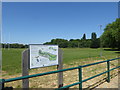
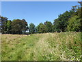
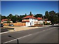
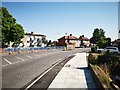
Area Overview for Charville Ward
Photos of Charville Ward
Area Information
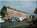
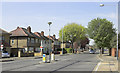
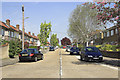
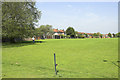
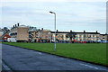
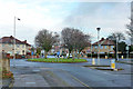
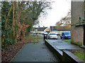
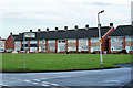
Living in Charville Ward offers a distinct experience within outer West London. This electoral ward sits inside the London Borough of Hillingdon, marking the boundary of the westernmost borough in Greater London. The area covers a compact 2.7 km², yet it accommodates a small community of approximately 1,693 residents. Such a low population density means you will notice the local atmosphere changes quickly as you move from one street to the next. The ward's geography is defined by its coordinates, placing it firmly at 51.532625425412746 latitude and -0.42801061227258924 longitude. Daily life here involves navigating a neighbourhood where every resident feels relatively close to their neighbours because there are so few of them overall. The small size of the area means local amenities and community interactions happen in concentrated pockets rather than being spread across a vast urban sprawl. You are looking at a specific pocket of London where the sense of scale remains manageable. This contrasts with larger districts where anonymity is the norm. The ward functions as a contained unit within the wider borough, providing a specific identity for those seeking a quieter slice of suburban London.
- Area Type
- District Borough Unitary Ward
- Area Size
- 2.7 km²
- Population
- 1693
- Population Density
- 636 people/km²
Demographics
The community profile of Charville Ward reflects a mature population rather than a youthful demographic. The median age stands at 70 years, which is exceptionally high compared to national averages. This figure indicates that a significant number of residents fall into the older age brackets. Households are likely to consist of people who have established their lives long ago and may be approaching retirement or already retired. The area does not attract young families or transient workers in large numbers based on this age data. Home ownership is a dominant feature of the local housing market. Sixty-five per cent of households own their homes outright or with a mortgage. This high rate suggests financial stability and a long-term commitment to the locality. You are less likely to encounter short-term rental arrangements here. The accommodation composition supports this view, showing a static and settled population structure. Diversity data is recorded in the total household figures, but the overwhelming age statistic defines the social fabric more than any other single demographic factor.
Household Size
Accommodation Type
Tenure
Ethnic Group
Religion
Household Composition
Age
Household Deprivation
NS-SEC
Explore more demographic insights in this area
Go to Demographics tabPlanning
Planning Constraints
- Flood RiskPremium
- Ramsar Wetland SitesPremium
- Area of Outstanding Natural BeautyPremium
- Protected Nature ReservePremium
- Protected WoodlandPremium
- Crime RiskPremium