Area Overview for Charlton Hornfair Ward
Photos of Charlton Hornfair Ward
Area Information
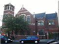
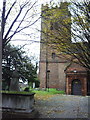
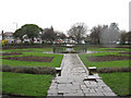
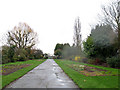
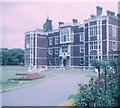
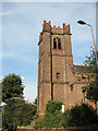
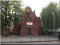
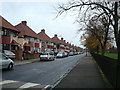
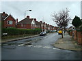
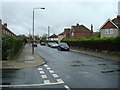
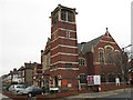
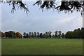
Living in Charlton Hornfair Ward offers a settled experience within the Royal Borough of Greenwich. This electoral ward covers an area size of 1.3 km², stretching north of Shooters Hill Road and east of the A102. The boundaries run from the Westcombe Park to Charlton railway line to Victoria Way, Canberra Road, and Charlton Park Lane. You will find residential neighbourhoods in Charlton, residents around the Royal Oak pub in Blackheath, and those living south of Queen Elizabeth Hospital in Woolwich. The ward was established in 2022 following a Local Government Boundary Commission for England review. This change ended a twenty-year period where much of the area voted for Kidbrooke councillors. Residents now identify more closely with Charlton, using local shops and community facilities within this new configuration. The area includes significant green spaces like Hornfair Park and Charlton Park, which form part of the Southeast London Green Chain network. Charlton Village with St Luke's Church is located within or very near the ward. You may also find the Charlton Lido in the south-east corner of the broader area. Those looking for homes in Charlton Hornfair Ward are entering a distinct community that has recently found its political voice while retaining strong links to historic landmarks.
- Area Type
- District Borough Unitary Ward
- Area Size
- 1.3 km²
- Population
- Not available
- Population Density
- Not available
Demographics
The community within Charlton Hornfair Ward has a distinct age profile. The median age for residents here is seventy years old. This high median age suggests a population skewed towards older adults rather than families with young children. Household composition and predominant ethnic group data are not specified for this location. Religion statistics are also unavailable for this specific ward. Home ownership stands at forty-four percent of all households. This indicates that more than half of the residents likely rent their accommodation. You should expect a mix of private and social housing depending on the specific street. The area does not have specific data regarding household composition breakdowns or predominant ethnic groups in this dataset. For those considering living in Charlton Hornfair Ward, the demographic picture points towards an area where older generations have settled. The fact that less than half of the residents own their homes suggests a reliance on rental sectors or shared ownership schemes. This demographic balance often creates a quieter environment compared to wards with many young professionals.
Household Size
Accommodation Type
Tenure
Ethnic Group
Religion
Household Composition
Age
Household Deprivation
NS-SEC
Explore more demographic insights in this area
Go to Demographics tabPlanning
Planning Constraints
- Flood RiskPremium
- Ramsar Wetland SitesPremium
- Area of Outstanding Natural BeautyPremium
- Protected Nature ReservePremium
- Protected WoodlandPremium
- Crime RiskPremium