Area Overview for Champion Hill Ward
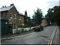
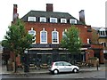
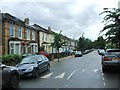
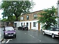
Photos of Champion Hill Ward
Area Information
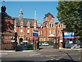
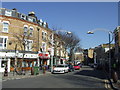
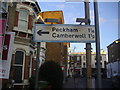
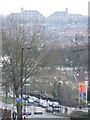
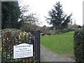
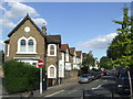
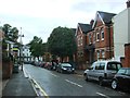
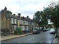
Living in Champion Hill Ward offers a distinct experience within South London, defined by its compact size and rich history. This electoral ward, located in the London Borough of Southwark, occupies just 1.1 km², making it a tightly defined neighbourhood. Its current population sits at 1,345 residents, creating a close-knit community at the point where Grove Vale meets Dog Kennel Hill. Historically, this land was separated from the rest of Dulwich by acres of open terrain, allowing it to evolve as a separate entity before modern road access connected it fully. The area retains significant heritage, including Champion Lodge, built in 1717 on the corner of Love Walk and Denmark Hill. You will find the legacy of entrepreneurial German businessmen who established City firms here long ago. Even the railway station, which originally opened in 1868 under the name Champion Hill, later became East Dulwich Station to avoid confusion with the adjacent Denmark Hill stop. Today, the ward stands as an integral part of the Dulwich Estate, offering a neighbourhood where history and daily life intersect.
- Area Type
- District Borough Unitary Ward
- Area Size
- 1.1 km²
- Population
- 1345
- Population Density
- 1278 people/km²
Demographics
The community in Champion Hill Ward is characterised by a very mature age profile. The median age for residents is 70, indicating a population significantly older than the national average. The demographic data classifies the total age range as the most common grouping, reflecting this older resident base. This profile suggests a quiet residential environment rather than a bustling family hub. Regarding property tenure, 41% of homes in the ward are owner-occupied. This figure implies that a substantial portion of the remaining 59% of households reside through renting arrangements. While specific data on household composition types, predominant ethnic groups, and religious affiliations are not broken down by age in the provided metrics, the overall population density stands at 1,278 people per km². This density places the ward in a moderate band for urban London living, balancing built-up infrastructure with residential space. The demographic snapshot paints a picture of a settled, elderly community with a mixed ownership landscape.
Household Size
Accommodation Type
Tenure
Ethnic Group
Religion
Household Composition
Age
Household Deprivation
NS-SEC
Explore more demographic insights in this area
Go to Demographics tabPlanning
Planning Constraints
- Flood RiskPremium
- Ramsar Wetland SitesPremium
- Area of Outstanding Natural BeautyPremium
- Protected Nature ReservePremium
- Protected WoodlandPremium
- Crime RiskPremium