Area Overview for Carshalton Central Ward
Photos of Carshalton Central Ward
Area Information
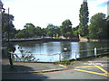
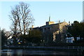
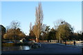
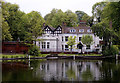
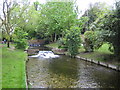
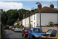
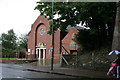
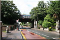
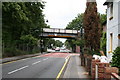
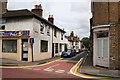
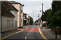
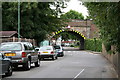
Living in Carshalton Central Ward offers a distinctly village-focused experience within the London Borough of Sutton. This electoral ward covers a small geographical area of just 2.2 km², yet it houses a community of approximately 2,813 residents. The location sits about 15.3 km southwest of Charing Cross, positioning it deep in south London while maintaining a close proximity to Sutton town centre, which lies only 1.9 km away. Daily life here is defined by the historic core of Carshalton town, centred around the River Wandle valley. You will find yourself surrounded by the picturesque Carshalton Ponds and the bustling High Street, both protected within the Carshalton Village Conservation Area. The ward's character remains deeply rooted in its history, having appear in local elections as early as 1964. Despite the presence of the busy A232 road linking to Croydon and Orpington, the neighbourhood retains visually scenic feelings around its ponds and leafy streets. Attacks on the village identity were forestalled in 1993 with the extension of the Conservation Area to include parts of Mill Lane and Talbot Road. For those seeking homes in Carshalton Central Ward, the environment provides a structured, village-like setting that feels removed from the density of the wider capital. The area balances historical significance, such as the Grade II listed Honeywood Museum, with contemporary family-oriented amenities and excellent school options nearby.
- Area Type
- District Borough Unitary Ward
- Area Size
- 2.2 km²
- Population
- 2813
- Population Density
- 1294 people/km²
Demographics
The community structure within Carshalton Central Ward reflects a mature population with a median age of 70 years. This high average suggests a district where long-term residents and older adults form the bulk of the local demographic. With a population density of 1,294 people per km², the ward supports a significant number of people within a compact space, yet the age profile indicates you are likely dealing with a community less focused on youth, toys, and school runs compared to other London boroughs. A striking feature of the area is the dominant rate of home ownership, which stands at 73 per cent. This figure points to a neighbourhood where stability is high, with most residents owning their homes outright or with a mortgage rather than renting. The high ownership rate often correlates with quieter streets and neighbourhoods that are less transient than rental-heavy zones. While specific data on household composition breakdowns or predominant ethnic groups are not listed, the high ownership level combined with the mature age profile paints a clear picture of a settled, owner-occupied society. If you are considering living in Carshalton Central Ward, you will join a demographic where residents have deep roots in the area, contributing to a steady, established community atmosphere rather than a transient or rapidly shifting population.
Household Size
Accommodation Type
Tenure
Ethnic Group
Religion
Household Composition
Age
Household Deprivation
NS-SEC
Explore more demographic insights in this area
Go to Demographics tabPlanning
Planning Constraints
- Flood RiskPremium
- Ramsar Wetland SitesPremium
- Area of Outstanding Natural BeautyPremium
- Protected Nature ReservePremium
- Protected WoodlandPremium
- Crime RiskPremium