Area Overview for Candlewick Ward
Photos of Candlewick Ward

Area Information
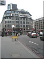
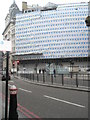
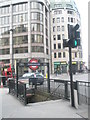
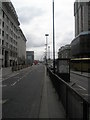
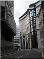
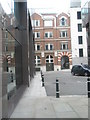
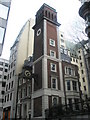
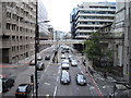
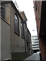
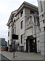
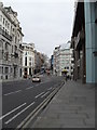
Living in Candlewick Ward means residing in one of the 25 electoral wards of the City of London. This small urban district covers just 5.2 hectares, situated between Bank and Monument stations. The area is bounded by wards including Cornhill, Lime Street, Langbourn, Walbrook, Cordwainer and Dowgate. Its main historical street remains Candlewick Street, now known as Cannon Street. First described in John Stow's 1603 *Survey of London* as Candlewicke Streete or Candlewright Streete Ward, this location began at the east end of Eastcheape and extended west through Candlewick Street to Suffolk Lane. The name derives from candle makers who worked along the street in medieval times. You will find a highly urban environment with a medieval street pattern of narrow lanes, alleys and roads. The landscape is dominated by neoclassical office buildings and corporate foyers, once mainly banks. It has a compact, historic City of London feel, busy with interchanges beneath but little explored above ground. Key points include the road junction at Monument station, which marks the start of the A3 and A10. Historic features include St Mary Abchurch, a Grade I listed Wren church, and the birthplace plaque for Alexander Pope in Plough Court. Parishes historically included All Hallows Lombard Street, St Clement Eastcheap, All Hallows Staining and St Mary. The ward is centred on Monument station and adjacent to Bank station, offering access to multiple transport lines. Roads include Cannon Street, Gracechurch Street, Eastcheap, King William Street and the ward's eastern boundary at Fish Street Hill.
- Area Type
- District Borough Unitary Ward
- Area Size
- 5.2 hectares
- Population
- Not available
- Population Density
- Not available
Demographics
Demographic data for Candlewick Ward is not provided in the current information set. Without specific figures on age profiles or household types, any discussion of the community composition remains speculative. You cannot determine ownership levels or accommodation diversity from the available records. Consequently, details regarding who lives here or the social makeup of the residents are absent from the dataset. Any attempt to describe the population would invent facts rather than state known realities. The ward is known for its medieval street pattern, but the people who inhabit these narrow lanes and alleys are not quantified by the available sources. Educational institutions near the area, such as schools near Candlewick Ward, are not listed in the provided research. The character of the area is defined by neoclassical office buildings and corporate foyers, yet this does not reveal the demographics of daily residents. You may find a compact, historic feel, but specific data on household sizes or income levels is missing. The warnings about interchanges below ground describe the infrastructure, not the commuters. Therefore, sections requiring specific numbers on ownership, age, or diversity must be omitted to maintain factual integrity. The history of the ward provides context, but current resident statistics are unavailable.
Household Size
Accommodation Type
Tenure
Ethnic Group
Religion
Household Composition
Age
Household Deprivation
NS-SEC
Explore more demographic insights in this area
Go to Demographics tabPlanning
Planning Constraints
- Flood RiskPremium
- Ramsar Wetland SitesPremium
- Area of Outstanding Natural BeautyPremium
- Protected Nature ReservePremium
- Protected WoodlandPremium