Area Overview for Camberwell Green Ward
Photos of Camberwell Green Ward
Area Information
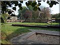
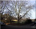
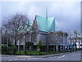
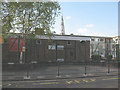
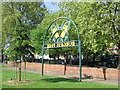
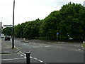
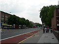
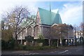
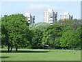
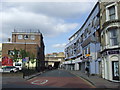
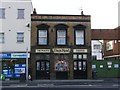
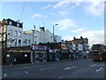
Camberwell Green Ward offers a distinct residential experience within the London Borough of Southwark. You will find a compact area spanning 92.9 hectares, yet it supports a population of 4,199 people. This ward is centred around Camberwell Green, a small patch of common land that historically served as a village green. The location sits approximately 2.75 miles southeast of Charing Cross. Originally a village in Surrey mentioned in the Domesday Book as Ca'brewelle, the area has a deep historical root. The ward encompasses the historic core of Camberwell, preserving a sense of place despite modern urban growth. Residents live amidst landmarks that date back centuries, including the boundary wall of Champion Lodge, built in 1717, and the civic space of Camberwell Green, which opened as a public park in 1859. Nearby, you will find Passmore Edwards Library and the historic Baths and Washhouse, which opened in 1903. The density reaches 4,519 people per square kilometre, creating a closeness that defines daily life in this part of South London. The area balances its village origins with its current status as an integral part of the city's fabric. Living here means being close to shared heritage sites and knowing the specific boundaries that define your neighbourhood.
- Area Type
- District Borough Unitary Ward
- Area Size
- 92.9 hectares
- Population
- 4199
- Population Density
- 4519 people/km²
Demographics
The community in Camberwell Green Ward has a notably older demographic profile. The median age is 70, which indicates a population heavily weighted towards older residents. Most common age statistics show this concentration clearly across the total population. This age distribution suggests the area may appeal strongly to retirees or those seeking quiet, established neighbourhoods. Home ownership stands at 26%, meaning the vast majority of residents rent their homes. This low ownership rate highlights a tenure heavily dependent on the private or social rental sectors. In terms of household composition and accommodation types, the data reflects a total picture without breaking down specific subsets of renters or owners further. You should expect a community where long-term tenancies or shared living arrangements are common rather than primary family estates. The diverse make-up of the ward includes various ethnic backgrounds and religious affiliations, though specific predominant figures for these categories are not detailed in the provided records. When considering the quality of life, the high population density of 4,519 people per square kilometre creates an urban atmosphere despite the local green spaces. This density contributes to the unique social dynamic of the ward, where neighbours are close both physically and culturally.
Household Size
Accommodation Type
Tenure
Ethnic Group
Religion
Household Composition
Age
Household Deprivation
NS-SEC
Explore more demographic insights in this area
Go to Demographics tabPlanning
Planning Constraints
- Flood RiskPremium
- Ramsar Wetland SitesPremium
- Area of Outstanding Natural BeautyPremium
- Protected Nature ReservePremium
- Protected WoodlandPremium
- Crime RiskPremium