Area Overview for Burnt Oak Ward
Photos of Burnt Oak Ward

Area Information
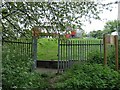
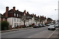
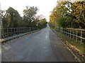
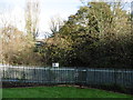
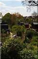
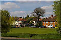
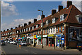
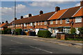
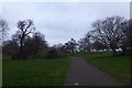
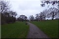
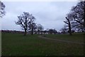
Living in Burnt Oak Ward offers a distinctly historic suburban experience situated approximately 9 miles northwest of Charing Cross. This district forms part of the London Borough of Barnet, though its boundaries extend across three boroughs including Brent and Harrow. The ward covers an area of 2.5 square kilometres and currently houses a population of 8,860 residents. You will find yourself surrounded by the legacy of the Watling Estate, which was completed in 1931 and transformed the landscape with 4,000 new homes. Originally agricultural land owned by Goldbeaters Farm, the area saw a rapid shift to urbanisation after Burnt Oak Underground station opened on the Northern line in 1924. Your daily life here is shaped by established commercial landmarks that have defined the community for nearly a century. The historic Bald Faced Stag pub remains a central gathering point, while Tesco, which opened its first store in the UK on Watling Avenue in 1931, continues to anchor the retail scene. Although the area has evolved from rural farmland to a dense residential zone, it retains pockets of green space within the Watling Estate. The neighbourhood functions as a self-contained community where modern convenience blends with historical character, making it a familiar choice for those seeking established housing in North London.
- Area Type
- District Borough Unitary Ward
- Area Size
- 2.5 km²
- Population
- 8860
- Population Density
- 3486 people/km²
Demographics
The community in Burnt Oak Ward displays a clear age profile with a median age of 70 years. This statistic indicates a population heavily weighted towards older residents compared to the national average. While specific breakdowns by single age groups are not detailed, the overall data confirms that the neighbourhood is not typically associated with young families or students. With a total population of 8,860 people spread across 2.5 square kilometres, the area achieves a population density of 3,486 people per square kilometre. Home ownership levels in this ward sit at 39 percent, suggesting that the majority of households consist of renters rather than owners. This figure shapes the social fabric and the types of properties that dominate the skyline. Accommodation types and household compositions follow this general trend of high tenancy rates, reflecting the area's origins as large-scale council housing built during the 1930s. The demographic landscape is defined by this concentration of older tenants who have lived in the area for decades. Factors such as ethnicity and religion are listed generally in available records, but the primary demographic characteristic remains the age structure. The high density combined with the older age profile creates a stable but quiet residential environment where long-term residents make up the bulk of the community.
Household Size
Accommodation Type
Tenure
Ethnic Group
Religion
Household Composition
Age
Household Deprivation
NS-SEC
Explore more demographic insights in this area
Go to Demographics tabPlanning
Planning Constraints
- Flood RiskPremium
- Ramsar Wetland SitesPremium
- Area of Outstanding Natural BeautyPremium
- Protected Nature ReservePremium
- Protected WoodlandPremium
- Crime RiskPremium