Area Overview for Brimsdown Ward
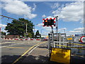
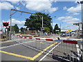
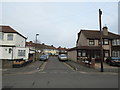
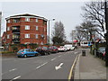
Photos of Brimsdown Ward
Area Information
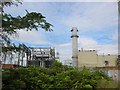
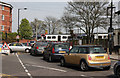
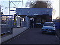
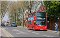
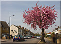
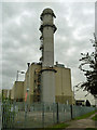
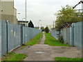
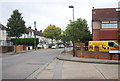
Brimsdown Ward occupies a distinct position on the eastern side of the London Borough of Enfield. This district spans four point six square kilometres and serves a population of 6,717 residents. The area is defined by a sharp geographical divide created by the Lea Valley Lines railway. You will find the main residential zone situated to the west of the tracks, largely comprising 1930s housing along Brimsdown Avenue. To the east of the railway line, the landscape shifts almost entirely to industrial use, hosting the Brimsdown Industrial Estate. This warehouse and business park area includes properties within the Watermill, Sovereign, Leeside Business Centres, and Riverwalk Business Park. Historically, the neighbourhood was once famous for market gardening and orchards before industry arrived in the early 1900s. The Brimsdown Power Station, which opened in 1903, anchored the industrial growth that continues today with the Enfield Power Station on the former site. Residential life centres around Durants Park, a large shared green space, while the nearby Goldsdown Park is home to Enfield Town FC. Living in Brimsdown Ward means navigating a community where historic character meets modern industrial development, with access to football clubs like Brimsdown Rovers, famously linked to David Beckham.
- Area Type
- District Borough Unitary Ward
- Area Size
- 4.6 km²
- Population
- 6717
- Population Density
- 1455 people/km²
Demographics
The population of Brimsdown Ward shows a significant focus on older residents. The median age for the area is 70 years, indicating a community where the majority of households include older adults or retirees. The data records the most common age category simply as Total, confirming a broad demographic mix without a specific young population skew. Home ownership stands at 46%, meaning nearly half of the residents own their properties outright or with a mortgage. This suggests a substantial proportion of older individuals who have built equity over the decades. The remaining 54% of the population likely resides in rented accommodation, which aligns with the presence of council house sites such as the one on Green Street. Errors in the historical data regarding religion and predominant ethnic group content imply a diverse community profile, though specific breakdowns are not available for this section. With a density of 1,455 people per square kilometre, the ward feels populated yet retains a distinct local identity separate from the immediate Enfield Chase. This demographic profile creates a quiet residential environment where daily interactions often involve neighbours of a similar generation managing fixed incomes and local amenities.
Household Size
Accommodation Type
Tenure
Ethnic Group
Religion
Household Composition
Age
Household Deprivation
NS-SEC
Explore more demographic insights in this area
Go to Demographics tabPlanning
Planning Constraints
- Flood RiskPremium
- Ramsar Wetland SitesPremium
- Area of Outstanding Natural BeautyPremium
- Protected Nature ReservePremium
- Protected WoodlandPremium
- Crime RiskPremium