Area Overview for BR7 6UP
Photos of BR7 6UP


Area Information
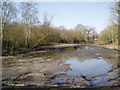
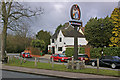
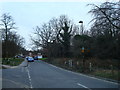
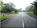
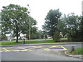
BR7 6UP is a small, tightly packed postcode area in the London Borough of Bromley, home to 1,635 residents spread across 794 people per square kilometre. This suburban cluster lies within Chislehurst, a district with historical roots dating back to the 10th century, when it was a royal manor. Today, it balances its heritage with modern living, offering a compact residential environment near Bromley, Sidcup, and Orpington. The area’s character is shaped by its proximity to Chislehurst Commons, a preserved green space of 180 acres, and its integration into London’s transport networks. Daily life here is defined by a mix of local amenities, including supermarkets, schools, and rail links, while the population’s median age of 47 suggests a community rooted in stability and long-term residency. For those seeking a quiet, well-connected suburb with a touch of history, BR7 6UP offers a snapshot of south-east London’s residential charm.
- Area Type
- Postcode
- Area Size
- Not available
- Population
- 1635
- Population Density
- 794 people/km²
BR7 6UP is a predominantly owner-occupied area, with 84% of homes owned by their residents rather than rented. The accommodation type is largely houses, not flats, which is typical of suburban London. This suggests a housing stock that prioritises family homes and long-term residency over short-term rental properties. Given the area’s small size and high population density, the property market is likely limited in scale, with few new developments. Buyers should consider the proximity to Chislehurst’s amenities and transport links, which may influence property values. However, the compact nature of the postcode means that opportunities are concentrated within a small radius, requiring careful consideration of local infrastructure and future growth potential.
House Prices in BR7 6UP
No properties found in this postcode.
Energy Efficiency in BR7 6UP
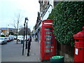
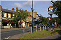
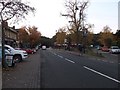
Living in BR7 6UP offers access to a mix of retail, dining, and recreational amenities. Local shops include Sainsburys Chislehurst, Co-op Chislehurst, and M&S Perry Street BP, providing everyday essentials. The area’s proximity to Chislehurst Commons, a preserved green space, offers opportunities for walking, picnicking, and outdoor activities. Transport links to rail, tram, and ferry services ensure easy access to nearby towns and London. The presence of multiple schools, community hubs, and historical sites like the Prince Imperial monument adds to the area’s character. This blend of practical amenities and natural spaces creates a balanced lifestyle, ideal for those seeking convenience without sacrificing green space.
Amenities
Schools
Residents of BR7 6UP have access to a range of schools, including primary and special needs institutions. St Nicholas Church of England Primary School holds an Ofsted rating of outstanding, offering a high standard of education. Coopers School, an academy, is rated good, while Marjorie McClure School specialises in special educational needs. Nearby, Coopers Technology College and St Nicholas Church of England Voluntary Aided Primary School provide additional primary options. The mix of school types ensures families can find appropriate education for children of all ages and abilities. This diversity reflects the area’s commitment to supporting educational needs, from mainstream learning to specialist provision, making it a practical choice for families.
| Rank | School | Type | Entry gender | Ages |
|---|
Explore more schools in this area
Go to Schools tabDemographics
The population of BR7 6UP is predominantly adults aged 30–64, with a median age of 47, reflecting a community of settled households. Home ownership is high at 84%, indicating a strong presence of long-term residents rather than renters. The area is primarily composed of houses, not flats, which aligns with its suburban character. The predominant ethnic group is White, though specific diversity metrics are not provided. With a population density of 794 people per square kilometre, the area is relatively compact, fostering a close-knit environment. The age profile suggests a mature demographic, potentially influencing local services and amenities. This data underscores a community focused on stability, with a low turnover of residents and a clear preference for owner-occupied housing.
Household Size
Accommodation Type
Tenure
Ethnic Group
Religion
Household Composition
Age
Household Deprivation
NS-SEC
Explore more demographic insights in this area
Go to Demographics tabPlanning
Planning Constraints
- Flood RiskPremium
- Ramsar Wetland SitesPremium
- Area of Outstanding Natural BeautyPremium
- Protected Nature ReservePremium
- Protected WoodlandPremium