Area Overview for BR7 6HN
Photos of BR7 6HN
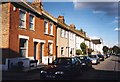
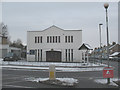
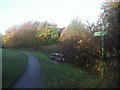
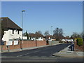
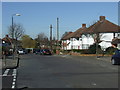
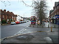
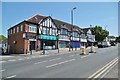
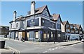
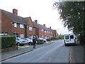
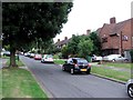
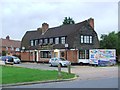
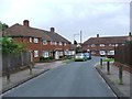
54 photos from this area
Area Information
Key information about the BR7 6HN including its size, population, and administrative classification.
- Area Type
- Postcode
- Area Size
- 6982 m²
- Population
- 1391
- Population Density
- 4182 people/km²
House Prices in BR7 6HN
25
Properties
£361,094
Average Sold Price
£134,000
Lowest Price
£550,000
Highest Price
Showing 25 properties
| Address | Type | Beds | Baths | Last Sale Price | Last Sale Date | |
|---|---|---|---|---|---|---|
| 25 Degema Road, Chislehurst, BR7 6HN | house | - | - | £550,000 | Mar 2023 | |
| 21 Degema Road, Chislehurst, BR7 6HN | house | 3 | - | £537,500 | Feb 2023 | |
| 13 Degema Road, Chislehurst, BR7 6HN | house | - | - | £470,000 | Jun 2021 | |
| 29 Degema Road, Chislehurst, BR7 6HN | Terraced | 3 | - | £490,000 | Dec 2020 | |
| 23 Degema Road, Chislehurst, BR7 6HN | Semi-detached | 3 | 2 | £528,500 | Nov 2018 | |
| 15 Degema Road, Chislehurst, BR7 6HN | house | 3 | - | £425,000 | May 2015 | |
| 9 Degema Road, Chislehurst, BR7 6HN | Semi-detached | 3 | 1 | £380,000 | Aug 2014 | |
| 31 Degema Road, Chislehurst, BR7 6HN | house | 3 | - | £350,000 | Aug 2011 | |
| 41 Degema Road, Chislehurst, BR7 6HN | house | 3 | - | £267,500 | Aug 2011 | |
| 45 Degema Road, Chislehurst, BR7 6HN | house | - | - | £287,500 | Apr 2011 |
Page 1 of 3
Energy Efficiency in BR7 6HN
Amenities
Schools
| Rank | School | Type | Entry gender | Ages |
|---|
Explore more schools in this area
Go to Schools tabDemographics
Household Size
Family (3-5 people)
most common
Accommodation Type
Houses
most common
Tenure
87
majority
Ethnic Group
White
most common
Religion
N/A
most common
Household Composition
N/A
most common
Age
47
median
Adults (30-64 years)
most common
Household Deprivation
N/A
with no deprivation
NS-SEC
51
in Lower managerial occupations
Explore more demographic insights in this area
Go to Demographics tabPlanning
Planning Constraints
- Flood RiskPremium
- Ramsar Wetland SitesPremium
- Area of Outstanding Natural BeautyPremium
- Protected Nature ReservePremium
- Protected WoodlandPremium