Area Overview for BR7 6HA
Photos of BR7 6HA
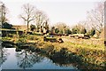

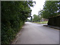
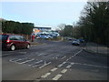
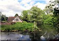
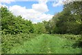

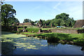
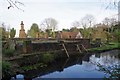
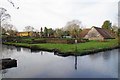
44 photos from this area
Area Information
Key information about the BR7 6HA including its size, population, and administrative classification.
- Area Type
- Postcode
- Area Size
- 21.9 hectares
- Population
- 1511
- Population Density
- 567 people/km²
House Prices in BR7 6HA
13
Properties
£987,500
Average Sold Price
£975,000
Lowest Price
£1,000,000
Highest Price
Showing 13 properties
| Address | Type | Beds | Baths | Last Sale Price | Last Sale Date | |
|---|---|---|---|---|---|---|
| Forge House, Perry Street, Chislehurst, BR7 6HA | Detached | 4 | - | £975,000 | Mar 2020 | |
| The Thatch, Perry Street, Chislehurst, BR7 6HA | Cottage | 3 | 2 | £1,000,000 | Dec 2019 | |
| Cadlands, Perry Street, Chislehurst, BR7 6HA | Detached | 5 | 3 | - | - | |
| Frogpool Manor Farm, Perry Street, Chislehurst, BR7 6HA | retail_financial | - | - | - | - | |
| The Flat, Frogpool Manor Farm, Perry Street, Chislehurst, BR7 6HA | Flat | - | - | - | - | |
| The Cottage, Cadlands, Perry Street, Chislehurst, BR7 6HA | Semi-detached | - | - | - | - | |
| Alva Glen, Perry Street, Chislehurst, BR7 6HA | Detached | - | - | - | - | |
| M&s Simply Food, Perry Street Service Station, Perry Street, Chislehurst, BR7 6HA | shop | - | - | - | - | |
| The Studio, The Thatch, Perry Street, Chislehurst, BR7 6HA | Flat | - | - | - | - | |
| Mandir The Lotus Centre, Perry Street, Chislehurst, BR7 6HA | warehouse | - | - | - | - |
Page 1 of 2
Energy Efficiency in BR7 6HA
Amenities
Schools
| Rank | School | Type | Entry gender | Ages |
|---|
Explore more schools in this area
Go to Schools tabDemographics
Household Size
One person
most common
Accommodation Type
Houses
most common
Tenure
81
majority
Ethnic Group
White
most common
Religion
N/A
most common
Household Composition
N/A
most common
Age
47
median
Adults (30-64 years)
most common
Household Deprivation
N/A
with no deprivation
NS-SEC
46
in Lower managerial occupations
Explore more demographic insights in this area
Go to Demographics tabPlanning
Planning Constraints
- Flood RiskPremium
- Ramsar Wetland SitesPremium
- Area of Outstanding Natural BeautyPremium
- Protected Nature ReservePremium
- Protected WoodlandPremium