Area Overview for BR7 6AU
Photos of BR7 6AU
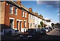
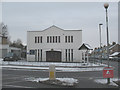
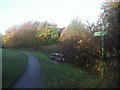
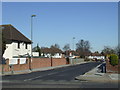
54 photos from this area
Area Information
Key information about the BR7 6AU including its size, population, and administrative classification.
- Area Type
- Postcode
- Area Size
- 2666 m²
- Population
- 1535
- Population Density
- 6351 people/km²
House Prices in BR7 6AU
10
Properties
£228,161
Average Sold Price
£159,000
Lowest Price
£340,000
Highest Price
Showing 10 properties
| Address | Type | Beds | Baths | Last Sale Price | Last Sale Date | |
|---|---|---|---|---|---|---|
| 1 Garrard Close, Chislehurst, BR7 6AU | Maisonette | 2 | - | £305,000 | Mar 2024 | |
| Humming View, 2 Garrard Close, Chislehurst, BR7 6AU | Maisonette | - | - | £320,000 | Sep 2021 | |
| 6 Garrard Close, Chislehurst, BR7 6AU | Flat | 2 | - | £340,000 | Oct 2018 | |
| 8 Garrard Close, Chislehurst, BR7 6AU | Maisonette | 2 | 1 | £192,000 | May 2013 | |
| 7 Garrard Close, Chislehurst, BR7 6AU | Maisonette | - | - | £215,000 | Sep 2011 | |
| 5 Garrard Close, Chislehurst, BR7 6AU | Maisonette | - | - | £185,000 | Aug 2010 | |
| 3 Garrard Close, Chislehurst, BR7 6AU | Flat | 2 | 1 | £159,000 | Jan 2007 | |
| 10 Garrard Close, Chislehurst, BR7 6AU | Flat | - | - | £172,500 | Feb 2005 | |
| 4 Garrard Close, Chislehurst, BR7 6AU | Flat | - | - | £164,950 | May 2003 | |
| 9 Garrard Close, Chislehurst, BR7 6AU | Flat | - | - | - | - |
Energy Efficiency in BR7 6AU
Amenities
Schools
| Rank | School | Type | Entry gender | Ages |
|---|
Explore more schools in this area
Go to Schools tabDemographics
Household Size
Family (3-5 people)
most common
Accommodation Type
Houses
most common
Tenure
67
majority
Ethnic Group
White
most common
Religion
N/A
most common
Household Composition
N/A
most common
Age
47
median
Adults (30-64 years)
most common
Household Deprivation
N/A
with no deprivation
NS-SEC
43
in Lower managerial occupations
Explore more demographic insights in this area
Go to Demographics tabPlanning
Planning Constraints
- Flood RiskPremium
- Ramsar Wetland SitesPremium
- Area of Outstanding Natural BeautyPremium
- Protected Nature ReservePremium
- Protected WoodlandPremium