Area Overview for BR7 5QD
Photos of BR7 5QD
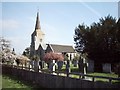
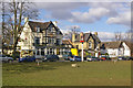
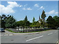
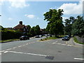
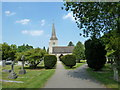
100 photos from this area
Area Information
Key information about the BR7 5QD including its size, population, and administrative classification.
- Area Type
- Postcode
- Area Size
- 8.7 hectares
- Population
- 1511
- Population Density
- 567 people/km²
House Prices in BR7 5QD
31
Properties
£878,036
Average Sold Price
£94,500
Lowest Price
£4,400,000
Highest Price
Showing 31 properties
| Address | Type | Beds | Baths | Last Sale Price | Last Sale Date | |
|---|---|---|---|---|---|---|
| Cornell House, Manor Park, Chislehurst, BR7 5QD | Bungalow | 3 | 2 | £1,290,000 | Jan 2025 | |
| Cookhamdene Lodge, Manor Park, Chislehurst, BR7 5QD | Detached | - | - | £4,400,000 | Jul 2022 | |
| 1, The Gorse, Manor Park, Chislehurst, BR7 5QD | Flat | - | - | £685,000 | Apr 2022 | |
| Chelwood, Manor Park, Chislehurst, BR7 5QD | Bungalow | - | - | £865,000 | Dec 2021 | |
| Friary Cottage, Manor Park, Chislehurst, BR7 5QD | house | - | - | £946,000 | Jul 2013 | |
| 3, The Gorse, Manor Park, Chislehurst, BR7 5QD | Flat | - | - | £585,000 | Nov 2007 | |
| April Cottage, Manor Park, Chislehurst, BR7 5QD | Detached | 4 | 2 | £550,000 | Aug 2007 | |
| Pine Lodge, Manor Park, Chislehurst, BR7 5QD | Detached | 3 | - | £535,000 | Jun 2004 | |
| Beechwood, Manor Park, Chislehurst, BR7 5QD | Detached | - | - | £625,000 | Jul 2002 | |
| 4, The Gorse, Manor Park, Chislehurst, BR7 5QD | Maisonette | - | - | £650,000 | Jun 2000 |
Page 1 of 4
Energy Efficiency in BR7 5QD
Amenities
Schools
| Rank | School | Type | Entry gender | Ages |
|---|
Explore more schools in this area
Go to Schools tabDemographics
Household Size
One person
most common
Accommodation Type
Houses
most common
Tenure
81
majority
Ethnic Group
White
most common
Religion
N/A
most common
Household Composition
N/A
most common
Age
47
median
Adults (30-64 years)
most common
Household Deprivation
N/A
with no deprivation
NS-SEC
46
in Lower managerial occupations
Explore more demographic insights in this area
Go to Demographics tabPlanning
Planning Constraints
- Flood RiskPremium
- Ramsar Wetland SitesPremium
- Area of Outstanding Natural BeautyPremium
- Protected Nature ReservePremium
- Protected WoodlandPremium