Area Overview for BR6 9XG
Photos of BR6 9XG
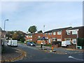
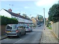
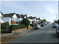
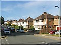
77 photos from this area
Area Information
Key information about the BR6 9XG including its size, population, and administrative classification.
- Area Type
- Postcode
- Area Size
- 7906 m²
- Population
- 2092
- Population Density
- 5203 people/km²
House Prices in BR6 9XG
20
Properties
£385,174
Average Sold Price
£278,995
Lowest Price
£530,000
Highest Price
Showing 20 properties
| Address | Type | Beds | Baths | Last Sale Price | Last Sale Date | |
|---|---|---|---|---|---|---|
| 34 Tregony Road, Orpington, BR6 9XG | Terraced | 3 | 3 | £525,000 | Sep 2025 | |
| 20 Tregony Road, Orpington, BR6 9XG | Terraced | 3 | 3 | £530,000 | Jan 2024 | |
| 18 Tregony Road, Orpington, BR6 9XG | Terraced | 3 | 3 | £470,000 | Aug 2020 | |
| 44 Tregony Road, Orpington, BR6 9XG | Semi-detached | 3 | 1 | £475,000 | Jan 2020 | |
| 38 Tregony Road, Orpington, BR6 9XG | Semi-detached | 3 | 3 | £475,000 | Oct 2019 | |
| 22 Tregony Road, Orpington, BR6 9XG | house | - | - | £480,000 | Aug 2018 | |
| 42 Tregony Road, Orpington, BR6 9XG | Terraced | 3 | 3 | £470,000 | Aug 2017 | |
| 40 Tregony Road, Orpington, BR6 9XG | house | - | - | £310,000 | Dec 2016 | |
| 52 Tregony Road, Orpington, BR6 9XG | house | - | - | £470,000 | Aug 2013 | |
| 54 Tregony Road, Orpington, BR6 9XG | house | 5 | - | £460,000 | Sep 2010 |
Page 1 of 2
Energy Efficiency in BR6 9XG
Amenities
Schools
| Rank | School | Type | Entry gender | Ages |
|---|
Explore more schools in this area
Go to Schools tabDemographics
Household Size
Family (3-5 people)
most common
Accommodation Type
Houses
most common
Tenure
90
majority
Ethnic Group
White
most common
Religion
N/A
most common
Household Composition
N/A
most common
Age
47
median
Adults (30-64 years)
most common
Household Deprivation
N/A
with no deprivation
NS-SEC
54
in Lower managerial occupations
Explore more demographic insights in this area
Go to Demographics tabPlanning
Planning Constraints
- Flood RiskPremium
- Ramsar Wetland SitesPremium
- Area of Outstanding Natural BeautyPremium
- Protected Nature ReservePremium
- Protected WoodlandPremium