Area Overview for BR6 9JR
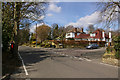
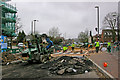
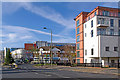
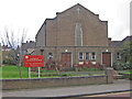
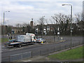
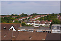
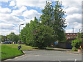
Photos of BR6 9JR
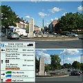


Area Information
BR6 9JR is a small residential postcode in the London Borough of Bromley, part of the semi-rural Petts Wood suburb. With a population of 2,297, it reflects a quiet, commuter-focused community. The area is defined by its 1920s garden suburb design, featuring woodland preserved by the National Trust and high-quality inter-war housing. Residents benefit from proximity to central London via rail links, with Petts Wood railway station serving the area. The semi-rural character contrasts with nearby urban amenities, offering a blend of green spaces and practical connectivity. Historical ties to the area include its 19th-century origins as a source of timber for naval dockyards and its role in the development of Daylight Saving Time. Daily life here is shaped by a mix of commuter routines and access to local parks, making it appealing for those seeking a balance between urban convenience and natural surroundings.
- Area Type
- Postcode
- Area Size
- Not available
- Population
- Not available
- Population Density
- Not available
BR6 9JR’s property market is characterised by a 56% home ownership rate, with flats being the primary accommodation type. This suggests a mix of owner-occupied and rental properties, though the exact proportion of rentals is not specified. The prevalence of flats may reflect the area’s semi-rural yet commuter-friendly design, with smaller, more compact homes suited to those prioritising ease of access to London. For buyers, this small postcode area offers limited housing stock, meaning competition may be higher for available properties. The focus on flats could also indicate a higher demand from younger professionals or retirees seeking low-maintenance living. Proximity to transport links, such as Petts Wood railway station, enhances the appeal of the area for those reliant on commuting, though the lack of larger homes may be a consideration for growing families.
House Prices in BR6 9JR
No properties found in this postcode.
Energy Efficiency in BR6 9JR
Living in BR6 9JR offers access to a range of amenities within practical reach. Retail options include major supermarkets like Tesco Orpington, Sainsburys Orpington, and Iceland Orpington, ensuring everyday shopping needs are met. The area’s proximity to Petts Wood and Hawkwood woodlands, managed by the National Trust, provides opportunities for walking, cycling, and nature appreciation. Nearby rail and tram stops connect residents to broader London networks, while two airports cater to travel requirements. The semi-rural setting, combined with urban retail and transport links, creates a balanced lifestyle. The presence of listed buildings like The Daylight Inn adds historical charm, and the preserved woodland areas offer a tranquil escape from urban life. This blend of natural and practical amenities supports a convenient, community-oriented way of living.
Amenities
Schools
Residents of BR6 9JR have access to two notable educational institutions. Orpington College of Further Education offers sixth-form education, catering to older students preparing for higher education or vocational training. Dorton College of Further Education specialises in special needs education, providing tailored support for students with specific learning requirements. While no Ofsted ratings are provided, the presence of both sixth-form and special schools suggests a diverse range of educational options for families. The mix of school types indicates that the area accommodates a spectrum of student needs, from post-16 education to specialist support. However, the absence of primary or secondary schools in the immediate vicinity may require families to travel to nearby areas for younger children’s education.
| Rank | School | Type | Entry gender | Ages |
|---|
Explore more schools in this area
Go to Schools tabDemographics
The population of BR6 9JR has a median age of 47, with the majority of residents aged 30–64. Home ownership stands at 56%, reflecting a mix of owner-occupied properties and rentals. The predominant accommodation type is flats, which aligns with the area’s suburban layout. The White ethnic group is the largest demographic, though no specific diversity statistics are provided. The age profile suggests a community of middle-aged adults, likely including professionals and families. The absence of detailed deprivation data means the area’s quality of life cannot be assessed in terms of socioeconomic challenges, but the median age and home ownership rate indicate a stable, established population. The focus on flats may imply a higher proportion of younger or older residents compared to other areas with larger family homes.
Household Size
Accommodation Type
Tenure
Ethnic Group
Religion
Household Composition
Age
Household Deprivation
NS-SEC
Explore more demographic insights in this area
Go to Demographics tabPlanning
Planning Constraints
- Flood RiskPremium
- Ramsar Wetland SitesPremium
- Area of Outstanding Natural BeautyPremium
- Protected Nature ReservePremium
- Protected WoodlandPremium