Area Overview for BR6 9JP
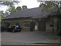
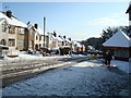
Photos of BR6 9JP


Area Information
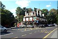
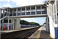
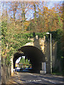
BR6 9JP is a small residential postcode in the London Borough of Bromley, encompassing parts of the semi-rural Petts Wood suburb. With a population of 2,297, it reflects a quiet, commuter-focused community characterised by 1920s garden suburb architecture. The area combines inter-war housing with preserved woodland, including Petts Wood, managed by the National Trust. Residents benefit from proximity to London’s transport network, with Orpington Station offering links to central London. The semi-rural setting contrasts with nearby urban hubs, offering a balance of green space and accessibility. Historical roots include its development as a garden suburb in the 1920s and 1930s, with public efforts to protect its natural landscape. Daily life here is shaped by its commuter orientation, with residents often working in London, and a focus on preserved natural environments. The area’s distinctiveness lies in its blend of suburban tranquillity and connectivity, making it appealing to those seeking a peaceful yet accessible lifestyle.
- Area Type
- Postcode
- Area Size
- Not available
- Population
- Not available
- Population Density
- Not available
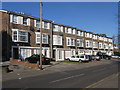
BR6 9JP’s property market is shaped by its 56% home ownership rate and the prevalence of flats. The housing stock consists largely of inter-war developments, with larger homes to the east of the railway line and smaller, densely packed properties to the west. This mix suggests a range of options for buyers, though the small area size limits availability. Flats dominate, indicating a focus on compact living, which may appeal to couples or professionals seeking affordability. However, the relatively low home ownership rate suggests a significant proportion of the housing stock is rented, potentially affecting market competition. Buyers should consider the age of properties, which date back to the 1920s and 1930s, and may require modernisation. The area’s semi-rural character and proximity to London make it attractive for those prioritising green space over urban density, though the limited supply of homes could drive up prices in the immediate vicinity.
House Prices in BR6 9JP
No properties found in this postcode.
Energy Efficiency in BR6 9JP
Residents of BR6 9JP have access to a range of amenities within practical reach. Retail options include major supermarkets such as Tesco Orpington, Sainsburys Orpington, and Iceland Orpington, ensuring convenience for daily shopping. The area’s semi-rural character is complemented by proximity to Petts Wood, a National Trust-managed woodland offering walking and leisure opportunities. Tram and rail stations provide easy access to London and surrounding areas, while nearby airports cater to regional travel. The preserved green spaces and historical sites, such as the British Summer Time sundial, add cultural and recreational value. This mix of retail, transport, and natural amenities supports a lifestyle that balances suburban comfort with urban connectivity, making BR6 9JP suitable for those seeking both convenience and a connection to nature.
Amenities
Schools
Near BR6 9JP are two further education institutions: Orpington College of Further Education, a sixth-form college, and Dorton College of Further Education, a special school. These institutions cater to older students and those with specific educational needs but do not provide primary or secondary schooling. Families with younger children would need to look beyond the immediate area for comprehensive education. The absence of local primary or secondary schools means parents may rely on nearby towns such as Orpington or Chislehurst for schooling. This dynamic is typical of suburban areas where educational facilities are concentrated in larger centres. The mix of sixth-form and special education options reflects the area’s role as a commuter suburb rather than a primary residential hub for young families.
| Rank | School | Type | Entry gender | Ages |
|---|
Explore more schools in this area
Go to Schools tabDemographics
The median age in BR6 9JP is 47, with the most common age range being adults aged 30–64. Home ownership stands at 56%, slightly below the UK average, suggesting a mix of owner-occupied and rental properties. The predominant accommodation type is flats, reflecting a housing stock suited to smaller households or couples. The majority of residents identify as White, with no specific data on other ethnic groups provided. This demographic profile indicates a stable, middle-aged population, likely with established careers and families. The absence of detailed diversity statistics means the community’s cultural composition remains less defined. The age range suggests a balance between working-age adults and those nearing retirement, though younger families are less represented. This profile aligns with a suburban area focused on commuter living rather than a younger, growing population.
Household Size
Accommodation Type
Tenure
Ethnic Group
Religion
Household Composition
Age
Household Deprivation
NS-SEC
Explore more demographic insights in this area
Go to Demographics tabPlanning
Planning Constraints
- Flood RiskPremium
- Ramsar Wetland SitesPremium
- Area of Outstanding Natural BeautyPremium
- Protected Nature ReservePremium
- Protected WoodlandPremium