Area Overview for BR6 9HZ
Photos of BR6 9HZ
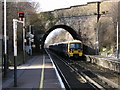
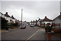
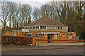
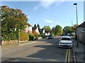
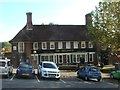
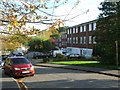
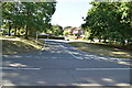
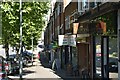
57 photos from this area
Area Information
Key information about the BR6 9HZ including its size, population, and administrative classification.
- Area Type
- Postcode
- Area Size
- 9693 m²
- Population
- 1627
- Population Density
- 1465 people/km²
House Prices in BR6 9HZ
21
Properties
£309,856
Average Sold Price
£90,950
Lowest Price
£536,000
Highest Price
Showing 21 properties
| Address | Type | Beds | Baths | Last Sale Price | Last Sale Date | |
|---|---|---|---|---|---|---|
| 173 Repton Road, Orpington, BR6 9HZ | Terraced | 2 | 1 | £480,000 | Jan 2025 | |
| 177 Repton Road, Orpington, BR6 9HZ | house | - | - | £536,000 | Nov 2022 | |
| 201 Repton Road, Orpington, BR6 9HZ | house | 3 | 1 | £491,000 | Mar 2021 | |
| 183 Repton Road, Orpington, BR6 9HZ | Semi-detached | 3 | 1 | £470,000 | May 2018 | |
| 191 Repton Road, Orpington, BR6 9HZ | Semi-detached | 3 | 1 | £369,995 | Apr 2015 | |
| 209 Repton Road, Orpington, BR6 9HZ | Semi-detached | 3 | 1 | £371,500 | Jun 2014 | |
| 195 Repton Road, Orpington, BR6 9HZ | Semi-detached | 3 | 1 | £280,000 | Jul 2012 | |
| 187 Repton Road, Orpington, BR6 9HZ | Semi-detached | 3 | - | £260,000 | Oct 2011 | |
| 207 Repton Road, Orpington, BR6 9HZ | house | - | - | £285,000 | Nov 2010 | |
| 211 Repton Road, Orpington, BR6 9HZ | Semi-detached | - | - | £237,500 | Sep 2007 |
Page 1 of 3
Energy Efficiency in BR6 9HZ
Amenities
Schools
| Rank | School | Type | Entry gender | Ages |
|---|
Explore more schools in this area
Go to Schools tabDemographics
Household Size
Family (3-5 people)
most common
Accommodation Type
Houses
most common
Tenure
77
majority
Ethnic Group
White
most common
Religion
N/A
most common
Household Composition
N/A
most common
Age
47
median
Adults (30-64 years)
most common
Household Deprivation
N/A
with no deprivation
NS-SEC
42
in Lower managerial occupations
Explore more demographic insights in this area
Go to Demographics tabPlanning
Planning Constraints
- Flood RiskPremium
- Ramsar Wetland SitesPremium
- Area of Outstanding Natural BeautyPremium
- Protected Nature ReservePremium
- Protected WoodlandPremium