Area Overview for BR6 9AW
Photos of BR6 9AW
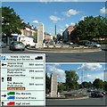
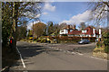
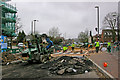
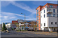
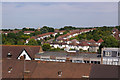
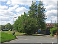
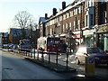
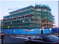
94 photos from this area
Area Information
Key information about the BR6 9AW including its size, population, and administrative classification.
- Area Type
- Postcode
- Area Size
- 1.5 hectares
- Population
- 1560
- Population Density
- 3346 people/km²
House Prices in BR6 9AW
24
Properties
£460,233
Average Sold Price
£127,000
Lowest Price
£1,000,000
Highest Price
Showing 24 properties
| Address | Type | Beds | Baths | Last Sale Price | Last Sale Date | |
|---|---|---|---|---|---|---|
| 8 Hillcrest Road, Orpington, BR6 9AW | house | - | - | £1,000,000 | Jul 2023 | |
| 2 Hillcrest Road, Orpington, BR6 9AW | Semi-detached | 4 | 2 | £810,000 | Jan 2023 | |
| 20 Hillcrest Road, Orpington, BR6 9AW | house | - | - | £795,000 | Dec 2020 | |
| 10 Hillcrest Road, Orpington, BR6 9AW | house | - | - | £730,000 | Aug 2018 | |
| 22 Hillcrest Road, Orpington, BR6 9AW | house | - | - | £440,000 | Sep 2010 | |
| 14 Hillcrest Road, Orpington, BR6 9AW | Semi-detached | 5 | 2 | £420,000 | Apr 2010 | |
| 28 Hillcrest Road, Orpington, BR6 9AW | house | - | - | £445,000 | Feb 2010 | |
| 24 Hillcrest Road, Orpington, BR6 9AW | house | - | - | £371,500 | Apr 2009 | |
| 30 Hillcrest Road, Orpington, BR6 9AW | Semi-detached | 5 | 2 | £310,000 | Dec 2004 | |
| 12 Hillcrest Road, Orpington, BR6 9AW | Semi-detached | - | - | £335,000 | Dec 2004 |
Page 1 of 3
Energy Efficiency in BR6 9AW
Amenities
Schools
| Rank | School | Type | Entry gender | Ages |
|---|
Explore more schools in this area
Go to Schools tabDemographics
Household Size
Family (3-5 people)
most common
Accommodation Type
Houses
most common
Tenure
93
majority
Ethnic Group
White
most common
Religion
N/A
most common
Household Composition
N/A
most common
Age
47
median
Adults (30-64 years)
most common
Household Deprivation
N/A
with no deprivation
NS-SEC
49
in Lower managerial occupations
Explore more demographic insights in this area
Go to Demographics tabPlanning
Planning Constraints
- Flood RiskPremium
- Ramsar Wetland SitesPremium
- Area of Outstanding Natural BeautyPremium
- Protected Nature ReservePremium
- Protected WoodlandPremium