Area Overview for BR6 8EN
Photos of BR6 8EN
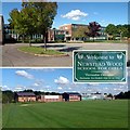
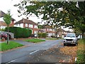
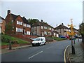
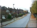
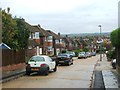
82 photos from this area
Area Information
Key information about the BR6 8EN including its size, population, and administrative classification.
- Area Type
- Postcode
- Area Size
- 2.4 hectares
- Population
- 1935
- Population Density
- 2222 people/km²
House Prices in BR6 8EN
32
Properties
£717,190
Average Sold Price
£351,000
Lowest Price
£1,400,000
Highest Price
Showing 32 properties
| Address | Type | Beds | Baths | Last Sale Price | Last Sale Date | |
|---|---|---|---|---|---|---|
| 112 Lovibonds Avenue, Orpington, BR6 8EN | Semi-detached | 3 | 1 | £690,000 | Mar 2025 | |
| 122 Lovibonds Avenue, Orpington, BR6 8EN | Detached | 5 | 1 | £1,400,000 | Oct 2024 | |
| 114 Lovibonds Avenue, Orpington, BR6 8EN | Semi-detached | 3 | 2 | £700,000 | Jul 2023 | |
| 137 Lovibonds Avenue, Orpington, BR6 8EN | Detached | 6 | 3 | £1,090,000 | Oct 2022 | |
| 143 Lovibonds Avenue, Orpington, BR6 8EN | Retail | 5 | 2 | £1,190,500 | Aug 2022 | |
| 144 Lovibonds Avenue, Orpington, BR6 8EN | house | - | - | £840,000 | May 2019 | |
| 134 Lovibonds Avenue, Orpington, BR6 8EN | Detached | 5 | - | £1,125,000 | Nov 2018 | |
| 118 Lovibonds Avenue, Orpington, BR6 8EN | Detached | 4 | 1 | £800,000 | Sep 2018 | |
| 130 Lovibonds Avenue, Orpington, BR6 8EN | Detached | 5 | 2 | £775,000 | Aug 2017 | |
| 136 Lovibonds Avenue, Orpington, BR6 8EN | Detached | 3 | 2 | £660,000 | Jul 2016 |
Page 1 of 4
Energy Efficiency in BR6 8EN
Amenities
Schools
| Rank | School | Type | Entry gender | Ages |
|---|
Explore more schools in this area
Go to Schools tabDemographics
Household Size
Family (3-5 people)
most common
Accommodation Type
Houses
most common
Tenure
91
majority
Ethnic Group
White
most common
Religion
N/A
most common
Household Composition
N/A
most common
Age
47
median
Adults (30-64 years)
most common
Household Deprivation
N/A
with no deprivation
NS-SEC
48
in Lower managerial occupations
Explore more demographic insights in this area
Go to Demographics tabPlanning
Planning Constraints
- Flood RiskPremium
- Ramsar Wetland SitesPremium
- Area of Outstanding Natural BeautyPremium
- Protected Nature ReservePremium
- Protected WoodlandPremium