Area Overview for BR6 7SN
Photos of BR6 7SN
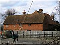
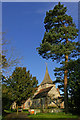
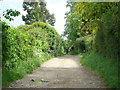
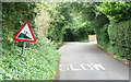
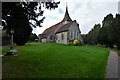
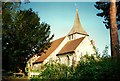
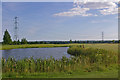
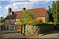
28 photos from this area
Area Information
Key information about the BR6 7SN including its size, population, and administrative classification.
- Area Type
- Postcode
- Area Size
- 33.9 hectares
- Population
- 1642
- Population Density
- 199 people/km²
House Prices in BR6 7SN
21
Properties
£1,383,750
Average Sold Price
£630,000
Lowest Price
£2,600,000
Highest Price
Showing 21 properties
| Address | Type | Beds | Baths | Last Sale Price | Last Sale Date | |
|---|---|---|---|---|---|---|
| Codlin Cottage, Church Road, Chelsfield, Orpington, BR6 7SN | Semi-detached | 3 | 2 | £805,000 | Mar 2024 | |
| Crossways, Church Road, Chelsfield, Orpington, BR6 7SN | Detached | 4 | 2 | £1,720,000 | Jan 2024 | |
| Florida, Church Road, Chelsfield, Orpington, BR6 7SN | Detached | 4 | 2 | £1,400,000 | Dec 2023 | |
| Moorings, Church Road, Chelsfield, Orpington, BR6 7SN | Detached | 6 | 5 | £2,600,000 | Jun 2018 | |
| Linden Cottage, Church Road, Chelsfield, Orpington, BR6 7SN | house | - | - | £630,000 | Jul 2015 | |
| Sunningdale, Church Road, Chelsfield, Orpington, BR6 7SN | Detached | 5 | - | £1,670,000 | Jun 2015 | |
| Darrickhurst Cottage, Church Road, Chelsfield, Orpington, BR6 7SN | house | 5 | - | £1,300,000 | Jan 2015 | |
| Birchwood, Church Road, Chelsfield, Orpington, BR6 7SN | Detached | 4 | - | £1,735,000 | Apr 2014 | |
| Valnord, Church Road, Chelsfield, Orpington, BR6 7SN | house | - | - | £800,000 | Apr 2014 | |
| The Coach House, Church Road, Chelsfield, Orpington, BR6 7SN | Detached | 3 | - | £700,000 | Jan 2014 |
Page 1 of 3
Energy Efficiency in BR6 7SN
Amenities
Schools
| Rank | School | Type | Entry gender | Ages |
|---|
Explore more schools in this area
Go to Schools tabDemographics
Household Size
Two person
most common
Accommodation Type
Houses
most common
Tenure
88
majority
Ethnic Group
White
most common
Religion
N/A
most common
Household Composition
N/A
most common
Age
47
median
Adults (30-64 years)
most common
Household Deprivation
N/A
with no deprivation
NS-SEC
47
in Lower managerial occupations
Explore more demographic insights in this area
Go to Demographics tabPlanning
Planning Constraints
- Flood RiskPremium
- Ramsar Wetland SitesPremium
- Area of Outstanding Natural BeautyPremium
- Protected Nature ReservePremium
- Protected WoodlandPremium