Area Overview for BR6 7LR
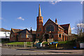
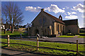
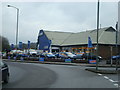
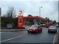
Photos of BR6 7LR
Area Information
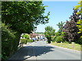
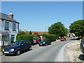
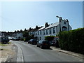
BR6 7LR lies within the Darwin Ward of the London Borough of Bromley, a historically rich area that blends rural charm with suburban convenience. The postcode covers a small residential cluster with a population of 1652, spread across 179 people per square kilometre. Its proximity to Downe, a village historically linked to Charles Darwin, adds a unique cultural layer. Residents here benefit from a tranquil setting, with easy access to nearby villages like Cudham and Westerham Hill. The area’s compact size means amenities and services are within practical reach, while its location near the M26 motorway ensures connectivity to London and surrounding regions. Daily life here is characterised by a mix of quiet residential streets and local hubs, with a focus on family-oriented living. The presence of Downe Primary School and nearby transport links, including Orpington Station, cater to both practical needs and community engagement. This is a place where historical significance meets modern living, offering a distinct blend of heritage and accessibility.
- Area Type
- Postcode
- Area Size
- Not available
- Population
- 1652
- Population Density
- 179 people/km²
The property market in BR6 7LR is characterised by a high rate of home ownership (87%), with houses forming the predominant type of accommodation. This suggests a market skewed towards owner-occupied properties rather than rentals, reflecting a community of long-term residents. The limited size of the postcode area means the housing stock is relatively small, with properties likely concentrated in the surrounding villages of Downe and Cudham. Buyers should consider the proximity to key amenities, such as schools, transport, and retail, which are all within practical reach. The presence of houses rather than flats indicates a focus on family-friendly living, with properties potentially offering more space and garden areas. However, the small size of the area may limit the variety of available homes, requiring buyers to look closely at nearby postcodes for additional options.
House Prices in BR6 7LR
No properties found in this postcode.
Energy Efficiency in BR6 7LR
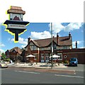
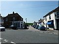
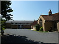
Residents of BR6 7LR have access to a range of amenities within practical reach. Retail options include Waitrose Green, Co-op Orpington, and Morrisons Daily, providing everyday shopping needs. The area’s proximity to rail stations like Chelsfield and Orpington Station, as well as tram stops such as Fieldway Tram Stop, ensures easy access to public transport. Nearby airports, including Biggin Hill Airport, add to the area’s connectivity. While specific parks or leisure facilities are not listed, the historical significance of Downe, home to Charles Darwin’s Down House, offers cultural and educational opportunities. The mix of retail, transport, and historical sites contributes to a lifestyle that balances convenience with a sense of place.
Amenities
Schools
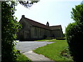
The nearest school to BR6 7LR is Downe Primary School, a primary education institution serving the local community. While the data lists this school twice, it is the only educational facility explicitly mentioned. The absence of secondary schools or other educational institutions within the postcode means families may need to look to nearby villages or towns for secondary education. The presence of a primary school suggests the area is well-served for younger children, though parents should verify the availability of secondary options. The school’s role in the community may contribute to a family-oriented atmosphere, with local amenities and services catering to the needs of students and their families.
| Rank | School | Type | Entry gender | Ages |
|---|
Explore more schools in this area
Go to Schools tabDemographics
The population of BR6 7LR has a median age of 47, with the majority of residents aged between 30 and 64. This suggests a community skewed towards middle-aged adults, likely including families and professionals. Home ownership is high at 87%, indicating a stable, long-term resident base. The area is predominantly composed of houses, reflecting a preference for single-family dwellings over flats or apartments. The predominant ethnic group is White, though specific diversity metrics are not provided. The population density of 179 people per square kilometre implies a low-rise, spread-out residential layout rather than a densely packed urban environment. This demographic profile suggests a neighbourhood where residents may prioritise space, stability, and proximity to local services. The absence of specific data on deprivation means that quality of life is inferred from the availability of amenities, transport, and safety assessments.
Household Size
Accommodation Type
Tenure
Ethnic Group
Religion
Household Composition
Age
Household Deprivation
NS-SEC
Explore more demographic insights in this area
Go to Demographics tabPlanning
Planning Constraints
- Flood RiskPremium
- Ramsar Wetland SitesPremium
- Area of Outstanding Natural BeautyPremium
- Protected Nature ReservePremium
- Protected WoodlandPremium