Area Overview for BR6 7GE
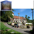
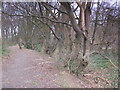
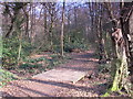
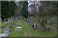
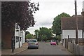
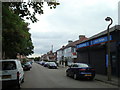
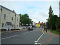
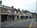
Photos of BR6 7GE


Area Information
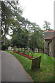
Living in BR6 7GE means residing within the Farnborough and Crofton Ward of the London Borough of Bromley. This extended electoral ward encompasses two distinct localities: Farnborough, a historic village named for Old English roots meaning 'village among the ferns on a hill', and Crofton, a suburb derived from 'farm on a rounded hill'. Despite Fitzwalking's inclusion in Greater London since 1965, its past lies partly within Kent. The postcode cluster BR6 7GE reflects this deep history while serving as a specific residential hub for 1,747 people. The population density reaches 1,263 people per square kilometre, creating a settled yet intimate community atmosphere. You will find yourself in an environment rooted in centuries of local heritage, from the 13th-century manor under Simon de Montfort to the 1638 rebuilding of St Giles' Church. The area's transformation from a rural parish split in 1934 between Bromley and Orpington shaped its modern layout. Residents today enjoy the convenience of being approximately 17 miles southeast of central London. This location balances quiet villages with accessible infrastructure, offering a stable environment where daily life is defined by established neighbourhoods rather than rapid development. Whether you are exploring homes in Farnborough or looking at the immediate surroundings of this postcode, you are entering a space with a long, documented history of local governance and community life.
- Area Type
- Postcode
- Area Size
- Not available
- Population
- 1747
- Population Density
- 1263 people/km²
The property market in BR6 7GE is characterised by a strong prevalence of ownership and traditional housing styles. With 79% home ownership, this postcode represents an area where residents largely purchase rather than rent their homes. This high level of tenure typically stabilises the local market and fosters a community where neighbourly ties endure over decades. The dominant accommodation type is houses, which aligns with the village origins of Farnborough and the suburban expansion of Crofton. Buyers looking at homes in BR6 7GE will primarily encounter domestic properties set within the established ward boundaries. This mix excludes high-density blocks or large-scale purpose-built estates, favouring established streets and localities. The concentration of owner-occupied homes suggests a market where equity and long-term investment are central values for residents. For prospective buyers, this environment offers the security of a settled housing stock. You are unlikely to encounter the volatility often associated with private rental concentrations in other parts of Greater London. Instead, the focus is on domestic living within the Farnborough and Crofton framework. This housing profile supports a desire for quiet, private residences rather than high-density urban living.
House Prices in BR6 7GE
No properties found in this postcode.
Energy Efficiency in BR6 7GE
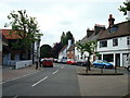
Residents of BR6 7GE benefit from a practical selection of retail, rail, and transport amenities within practical reach. You have access to five retail locations including the Co-op Orpington, Sainsburys Locksbottom, and M&S Rosetta Orpington BP. These supermarkets and stores cover your weekly shopping requirements without requiring a daily commute to town. Transport choices are extensive, with five rail stations situated nearby, including Orpington Station, Chelsfield, and Petts Wood. These hubs allow you to travel across the borough or to central London efficiently. Additionally, two airports, Biggin Hill Airport and London Biggin Hill Airport, provide options for private or general aviation within the vicinity. For alternative transport, five metro stops serve the area, such as New Addington Tram Stop, King Henry's Drive Tram Stop, and Fieldway Tram Stop. This network connects you to the wider Waldo and Bromley infrastructure. The lifestyle offered is one of convenience, where essential services and transport links are clustered near your postcode. You can manage shopping, commuting, and leisure from a central point. The presence of these specific venues confirms that daily life in BR6 7GE is well-linked to the surrounding commercial and transport networks.
Amenities
Schools
Families in BR6 7GE have access to established educational facilities within walking distance or short travel time. The most notable institution listed is Farnborough Primary School, which serves as a primary school with a Ofsted rating of good. This rating indicates a standard of performance recognised by the education authorities. As a primary school, it forms the first educational step for children residing in the Farnborough locality of the ward. The specific Ofsted rating provides confidence to parents considering schools near BR6 7GE for their children's early education. Currently, the data highlights only this specific primary provision within the immediate vicinity of the postcode. You should consider this school if you are searching for education options close to home in the Farnborough and Crofton area. While the list in the provided records focuses on primary education, the presence of a good-rated school indicates access to quality foundation learning. Parents relying on local education will find this primary option fits the community profile of the ward. The availability of a good-rated primary school supports the area's appeal to the 30-64 age demographic who seek domestic stability.
| Rank | School | Type | Entry gender | Ages |
|---|
Explore more schools in this area
Go to Schools tabDemographics
The community in BR6 7GE is defined by stability and established residency. The median age is 47 years, and the most common age range covers adults between 30 and 64 years. This demographic profile indicates a neighbourhood where the working-age population forms the backbone of daily life. Home ownership stands at 79%, marking this as a predominantly owner-occupied neighbourhood. Such a high level of tenure suggests long-term residents who are invested in the local area. Accommodation types are primarily houses, fitting the suburb and village character of Farnborough and Crofton. The predominant ethnic group is White, reflecting a demographically consistent community. You will not find pockets of temporary lifestyle choice or nomadic youth presence in the core of this ward. The high home ownership rate often correlates with lower rates of transient housing, creating a sense of permanence among neighbours. This stability contributes significantly to the quality of life for families and individuals seeking a settled environment. When considering living in BR6 7GE, you are choosing an area where the majority of households have taken a long-term commitment to their property. This historical stability is evident across the Farnborough and Crofton landscape and remains a defining feature of the ward's social fabric.
Household Size
Accommodation Type
Tenure
Ethnic Group
Religion
Household Composition
Age
Household Deprivation
NS-SEC
Explore more demographic insights in this area
Go to Demographics tabPlanning
Planning Constraints
- Flood RiskPremium
- Ramsar Wetland SitesPremium
- Area of Outstanding Natural BeautyPremium
- Protected Nature ReservePremium
- Protected WoodlandPremium