Area Overview for BR6 6ST
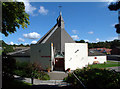
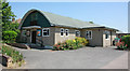
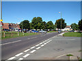
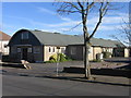
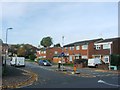
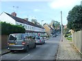
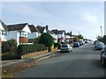
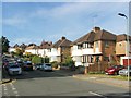
Photos of BR6 6ST
Area Information
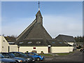
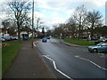
BR6 6ST is a small residential postcode area in southeast London, part of the London Borough of Bromley. With a population of 1494, it reflects a compact, tightly knit community. The area combines historic village character with post-war development, particularly in the New Chelsfield area near the railway station. Centred around the village of Chelsfield, it is bordered by Green Street Green, Goddington, and Well Hill. The A224 road separates the village from its church, St Martin of Tours, a Grade II* listed building dating to the early Norman period. BR6 6ST offers a mix of rural charm and commuter convenience, with proximity to Orpington and easy access to London via rail. Daily life here is shaped by its small-scale nature, with local amenities and transport links serving both residents and nearby areas. The area’s history as a stopping point for drovers and its 19th-century railway development underscore its enduring role as a commuter hub with a distinct local identity.
- Area Type
- Postcode
- Area Size
- Not available
- Population
- Not available
- Population Density
- Not available
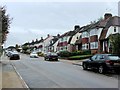
BR6 6ST is predominantly an owner-occupied area, with 80% of homes owned by residents rather than rented. The accommodation type is largely houses, which is typical of suburban settings and contrasts with higher-density housing in urban areas. This suggests a market skewed towards family homes and long-term residency, with limited rental activity. The small postcode area implies a restricted housing stock, potentially limiting options for buyers. The blend of historic village properties and post-war developments in New Chelsfield may offer a range of architectural styles, though the overall market is likely constrained by the area’s size. For buyers, this means a focus on individual properties rather than a broad selection, with potential value in established homes that reflect the area’s character and proximity to transport links.
House Prices in BR6 6ST
No properties found in this postcode.
Energy Efficiency in BR6 6ST
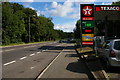
BR6 6ST offers a range of amenities within practical reach, including retail outlets such as Co-op Orpington, Waitrose Green, and Morrisons Daily. These shops provide everyday essentials, supporting a self-contained lifestyle. The area’s transport network includes multiple rail stations, such as Chelsfield and Orpington, and tram stops like New Addington, which link to London and surrounding areas. Airports like Biggin Hill are nearby, adding to the area’s accessibility. While specific parks or leisure facilities are not detailed in the data, the presence of listed buildings and conservation areas suggests a blend of historical interest and community spaces. The mix of retail, transport, and proximity to airports contributes to a practical, convenient lifestyle, catering to both daily needs and broader travel requirements.
Amenities
Schools
The nearest school to BR6 6ST is Warren Road Primary School, which serves the local community. This primary school has an Ofsted rating of outstanding, indicating high-quality education and effective teaching standards. The presence of a single primary school suggests that families in BR6 6ST rely on this institution for early education, with no secondary schools listed in the data. The outstanding rating is a strong indicator for prospective homebuyers concerned about educational provision, though the absence of secondary schools may necessitate travel for older students. The school’s performance reflects positively on the area’s commitment to education, aligning with the demographic profile of middle-aged and older residents who may prioritise stable, high-performing schools for their children.
| Rank | School | Type | Entry gender | Ages |
|---|
Explore more schools in this area
Go to Schools tabDemographics
The population of BR6 6ST has a median age of 47, with the majority of residents aged 30–64 years. This suggests a community dominated by middle-aged and older adults, likely including families and retirees. Home ownership is high, at 80%, indicating a stable, long-term resident base. The area is primarily composed of houses, reflecting a suburban character rather than high-density living. The predominant ethnic group is White, though specific data on other groups is not provided. The age profile and ownership figures imply a mature, established neighbourhood with limited turnover. With no data on deprivation levels, the focus remains on the demographic stability and the presence of a core adult population, which may influence local services and amenities tailored to their needs.
Household Size
Accommodation Type
Tenure
Ethnic Group
Religion
Household Composition
Age
Household Deprivation
NS-SEC
Explore more demographic insights in this area
Go to Demographics tabPlanning
Planning Constraints
- Flood RiskPremium
- Ramsar Wetland SitesPremium
- Area of Outstanding Natural BeautyPremium
- Protected Nature ReservePremium
- Protected WoodlandPremium