Area Overview for BR6 6HE
Photos of BR6 6HE
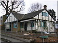
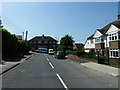
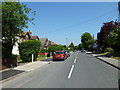
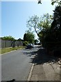
60 photos from this area
Area Information
Key information about the BR6 6HE including its size, population, and administrative classification.
- Area Type
- Postcode
- Area Size
- 1.1 hectares
- Population
- 1388
- Population Density
- 1509 people/km²
House Prices in BR6 6HE
26
Properties
£368,800
Average Sold Price
£118,500
Lowest Price
£1,027,000
Highest Price
Showing 26 properties
| Address | Type | Beds | Baths | Last Sale Price | Last Sale Date | |
|---|---|---|---|---|---|---|
| 79 Windsor Drive, Orpington, BR6 6HE | Detached | 4 | 2 | £1,027,000 | Jul 2023 | |
| 101 Windsor Drive, Orpington, BR6 6HE | Semi-detached | 3 | 1 | £530,000 | May 2023 | |
| 87 Windsor Drive, Orpington, BR6 6HE | Semi-detached | 3 | 1 | £565,000 | Feb 2022 | |
| 117 Windsor Drive, Orpington, BR6 6HE | Semi-detached | 3 | 2 | £472,000 | Dec 2018 | |
| 103 Windsor Drive, Orpington, BR6 6HE | Semi-detached | 3 | 1 | £438,000 | Jun 2018 | |
| 99 Windsor Drive, Orpington, BR6 6HE | house | - | - | £535,000 | Apr 2017 | |
| 91 Windsor Drive, Orpington, BR6 6HE | house | - | - | £310,000 | Dec 2013 | |
| 97 Windsor Drive, Orpington, BR6 6HE | Semi-detached | - | - | £297,500 | May 2010 | |
| 123 Windsor Drive, Orpington, BR6 6HE | Semi-detached | 3 | 2 | £250,000 | Oct 2005 | |
| 83 Windsor Drive, Orpington, BR6 6HE | Semi-detached | - | - | £235,000 | Aug 2004 |
Page 1 of 3
Energy Efficiency in BR6 6HE
Amenities
Schools
| Rank | School | Type | Entry gender | Ages |
|---|
Explore more schools in this area
Go to Schools tabDemographics
Household Size
Family (3-5 people)
most common
Accommodation Type
Houses
most common
Tenure
93
majority
Ethnic Group
White
most common
Religion
N/A
most common
Household Composition
N/A
most common
Age
47
median
Adults (30-64 years)
most common
Household Deprivation
N/A
with no deprivation
NS-SEC
53
in Lower managerial occupations
Explore more demographic insights in this area
Go to Demographics tabPlanning
Planning Constraints
- Flood RiskPremium
- Ramsar Wetland SitesPremium
- Area of Outstanding Natural BeautyPremium
- Protected Nature ReservePremium
- Protected WoodlandPremium