Area Overview for BR6 6DT
Photos of BR6 6DT
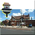
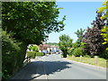
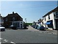
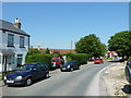
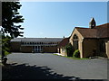
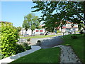
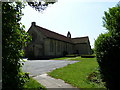
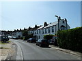
100 photos from this area
Area Information
Key information about the BR6 6DT including its size, population, and administrative classification.
- Area Type
- Postcode
- Area Size
- 2.0 hectares
- Population
- Not available
- Population Density
- Not available
House Prices in BR6 6DT
33
Properties
£403,341
Average Sold Price
£87,000
Lowest Price
£680,000
Highest Price
Showing 33 properties
| Address | Type | Beds | Baths | Last Sale Price | Last Sale Date | |
|---|---|---|---|---|---|---|
| 32 Vine Road, Orpington, BR6 6DT | Semi-detached | 3 | 2 | £680,000 | Mar 2025 | |
| 11 Vine Road, Orpington, BR6 6DT | Semi-detached | 3 | 1 | £531,500 | Dec 2022 | |
| 34 Vine Road, Orpington, BR6 6DT | Semi-detached | 3 | 1 | £545,000 | Nov 2022 | |
| 30 Vine Road, Orpington, BR6 6DT | house | - | - | £600,000 | Jan 2022 | |
| 44 Vine Road, Orpington, BR6 6DT | house | 3 | - | £532,000 | Dec 2021 | |
| 19 Vine Road, Orpington, BR6 6DT | house | - | - | £595,000 | May 2021 | |
| 38 Vine Road, Orpington, BR6 6DT | house | - | - | £617,000 | Dec 2020 | |
| 40 Vine Road, Orpington, BR6 6DT | house | - | - | £540,000 | Nov 2020 | |
| 13 Vine Road, Orpington, BR6 6DT | Semi-detached | 3 | 1 | £385,000 | Mar 2019 | |
| 21 Vine Road, Orpington, BR6 6DT | Detached | 4 | 2 | £512,000 | Mar 2018 |
Page 1 of 4
Energy Efficiency in BR6 6DT
Amenities
Schools
| Rank | School | Type | Entry gender | Ages |
|---|
Explore more schools in this area
Go to Schools tabDemographics
Household Size
Two person
most common
Accommodation Type
Houses
most common
Tenure
86
majority
Ethnic Group
White
most common
Religion
N/A
most common
Household Composition
N/A
most common
Age
47
median
Adults (30-64 years)
most common
Household Deprivation
N/A
with no deprivation
NS-SEC
47
in Lower managerial occupations
Explore more demographic insights in this area
Go to Demographics tabPlanning
Planning Constraints
- Flood RiskPremium
- Ramsar Wetland SitesPremium
- Area of Outstanding Natural BeautyPremium
- Protected Nature ReservePremium
- Protected WoodlandPremium